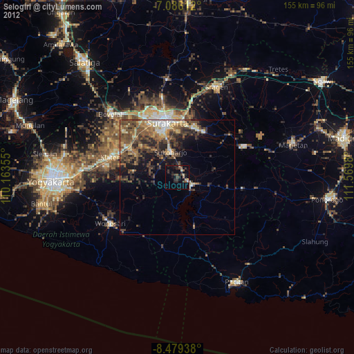
Selogiri night lights from space
Night Light of Selogiri (Central Java) from space (Indonesia) Src. Average luminocity for 10x10km area is 13.343% and for 50x50km: 14.4903%.
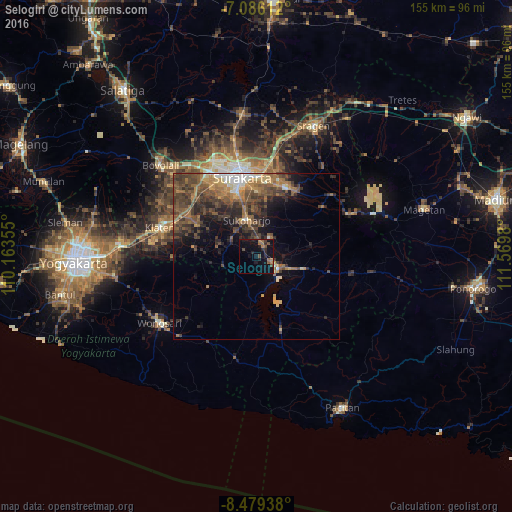
Analysis of Selogiri night lights 2016
Square area 10x10 km:
100  0%
0%
90-99 0%
80-89 0%
70-79 0.41%
60-69 4.55%
50-59 2.89%
40-49 3.72%
30-39 1.03%
20-29 5.37%
10-19 19.01%
0-9 63.02%
0%90-99
0%80-89
0%70-79
0.41%60-69
4.55%50-59
2.89%40-49
3.72%30-39
1.03%20-29
5.37%10-19
19.01%0-9
63.02%Square area 50x50 km:
100 0.86%
90-99 1.26%
80-89 1.14%
70-79 1.83%
60-69 3.25%
50-59 3.35%
40-49 4.68%
30-39 3.96%
20-29 4.54%
10-19 5.83%
0-9 69.29%
0.86%90-99
1.26%80-89
1.14%70-79
1.83%60-69
3.25%50-59
3.35%40-49
4.68%30-39
3.96%20-29
4.54%10-19
5.83%0-9
69.29%Clear (daylight) street map image can be seen on geolist.org.
Map coordinates:
7° 5' 10" South, 110° 9' 48.8" East
7° 46' 60" South, 110° 52' 0" East
8° 28' 45.8" South, 111° 34' 11.3" East
Some cities around Selogiri sort by population:
• Surakarta
25.6 km =15.9 mi,  351°
351°
• Grogol
20.9 km =13 mi, 345°
• Baki
21 km =13 mi,  334°
334°
• Gatak
27.9 km =17.3 mi,  320°
320°
• Jaten
23.2 km =14.4 mi,  8°
8°
• Ceper
24 km =14.9 mi,  300°
300°
• Delanggu
27.4 km =17 mi,  312°
312°
• Trucuk
24 km =14.9 mi,  287°
287°
1627969 (p: 30,180)
Sources (retrieved 2019-11-25):
» Earth at Night: Flat Maps 2012, 2016