Jaten night lights from space
Night Light of Jaten (Central Java) from space (Indonesia) Src. Average luminocity for 10x10km area is 62.8853% and for 50x50km: 24.5018%.
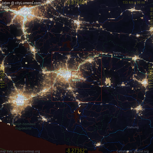
Analysis of Jaten night lights 2016
Square area 10x10 km:
 1.73%
1.73%90-99
5.41%80-89
10.39%70-79
16.45%60-69
24.46%50-59
16.88%40-49
15.58%30-39
8.23%20-29
0.87%10-19
0%0-9
0%Square area 50x50 km:
1.48%90-99
2.37%80-89
1.74%70-79
3.21%60-69
4.9%50-59
5.45%40-49
7.63%30-39
6.69%20-29
9.07%10-19
12.8%0-9
44.65%Clear (daylight) street map image can be seen on geolist.org.
Map coordinates:
6° 52' 46.9" South, 110° 11' 39.8" East
7° 34' 38" South, 110° 53' 51" East
8° 16' 25" South, 111° 36' 2.3" East
Some cities around Jaten sort by population:
• Surakarta
7.6 km =4.7 mi,  287°
287°
• Grogol
9.1 km =5.7 mi,  253°
253°
• Kartasura
17.8 km =11.1 mi,  279°
279°
• Sragen
21.7 km =13.5 mi,  39°
39°
• Baki
13.1 km =8.1 mi, 252°
• Gatak
21.3 km =13.2 mi,  265°
265°
• Colomadu
17 km =10.6 mi, 286°
• Ngemplak
20.2 km =12.6 mi, 278°
1642754 (p: 32,378)
Sources (retrieved 2019-11-25):
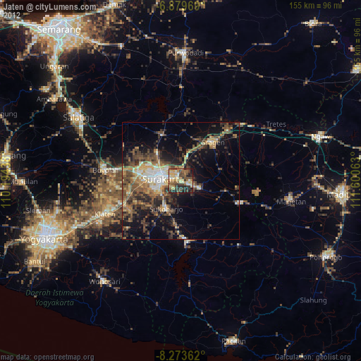
» Earth at Night: Flat Maps 2012, 2016