Munduk night lights from space
Night Light of Munduk (Bali) from space (Indonesia) Src. Average luminocity for 10x10km area is 0.5558% and for 50x50km: 5.8119%.
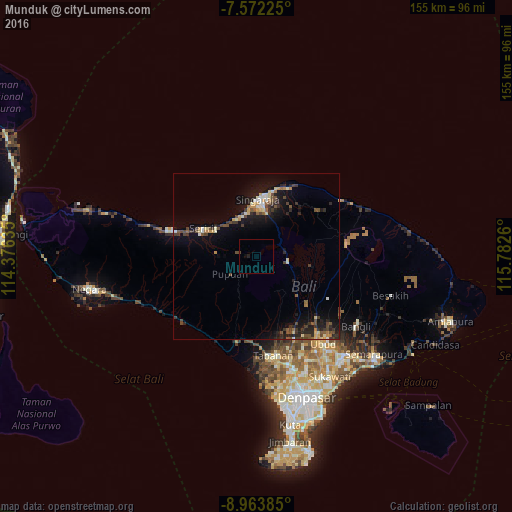
Analysis of Munduk night lights 2016
Square area 10x10 km:
 0%
0%90-99
0%80-89
0%70-79
0%60-69
0%50-59
0%40-49
0.41%30-39
0%20-29
0.83%10-19
0.21%0-9
98.55%Square area 50x50 km:
0.14%90-99
0.9%80-89
0.74%70-79
0.58%60-69
0.38%50-59
0.86%40-49
1.4%30-39
1.28%20-29
1.78%10-19
4.76%0-9
87.18%Clear (daylight) street map image can be seen on geolist.org.
Map coordinates:
7° 34' 20.1" South, 114° 22' 34.9" East
8° 16' 7.2" South, 115° 4' 46.1" East
8° 57' 49.9" South, 115° 46' 57.4" East
Some cities around Munduk sort by population:
• Denpasar
45 km =28 mi,  160°
160°
• Singaraja
17.4 km =10.8 mi,  3°
3°
• Banjar
15.1 km =9.4 mi,  305°
305°
• Tabanan
30.7 km =19.1 mi,  170°
170°
• Ubud
33.7 km =20.9 mi,  142°
142°
• Klungkung
45.9 km =28.5 mi,  129°
129°
• Seririt
17.6 km =10.9 mi,  298°
298°
• Lovina
14 km =8.7 mi,  341°
341°
1634710 (p: 6,200)
Sources (retrieved 2019-11-25):
» Earth at Night: Flat Maps 2012, 2016