Banjar night lights from space
Night Light of Banjar (Bali) from space (Indonesia) Src. Average luminocity for 10x10km area is 15.8719% and for 50x50km: 4.4244%.
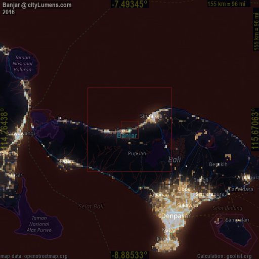
Analysis of Banjar night lights 2016
Square area 10x10 km:
 0.41%
0.41%90-99
3.1%80-89
2.69%70-79
2.48%60-69
0.41%50-59
2.07%40-49
4.13%30-39
2.07%20-29
0.83%10-19
2.69%0-9
79.13%Square area 50x50 km:
0.15%90-99
0.9%80-89
0.51%70-79
0.53%60-69
0.23%50-59
0.55%40-49
0.96%30-39
0.74%20-29
0.88%10-19
3.35%0-9
91.2%Clear (daylight) street map image can be seen on geolist.org.
Map coordinates:
7° 29' 36.4" South, 114° 15' 51.8" East
8° 11' 24" South, 114° 58' 3" East
8° 53' 7.2" South, 115° 40' 14.3" East
Some cities around Banjar sort by population:
• Denpasar
58 km =36 mi,  151°
151°
• Singaraja
15.9 km =9.9 mi,  56°
56°
• Tabanan
42.7 km =26.5 mi,  156°
156°
• Negara
42.8 km =26.6 mi,  244°
244°
• Ubud
48.4 km =30.1 mi,  137°
137°
• Seririt
3.2 km =2 mi,  264°
264°
• Lovina
9.2 km =5.7 mi, 60°
• Munduk
15.1 km =9.4 mi,  125°
125°
1650232 (p: 89,040)
Sources (retrieved 2019-11-25):
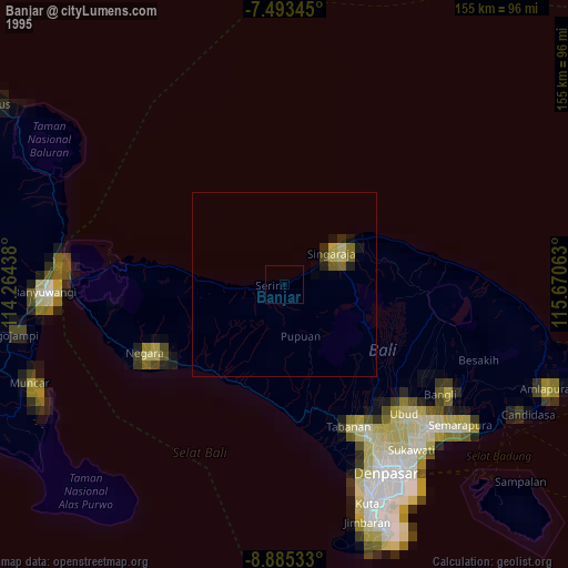
» NASA, Earths city lights 1995
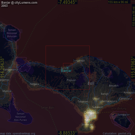
» NASA city lights 2003
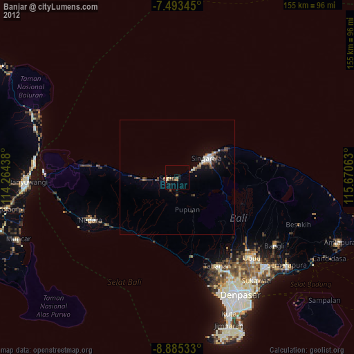
» Earth at Night: Flat Maps 2012, 2016