Majalengka night lights from space
Night Light of Majalengka (West Java) from space (Indonesia) Src. Average luminocity for 10x10km area is 12.2056% and for 50x50km: 6.9456%.
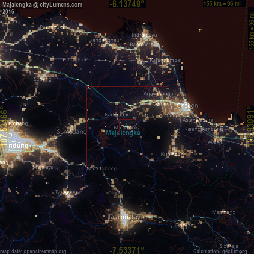
Analysis of Majalengka night lights 2016
Square area 10x10 km:
 0%
0%90-99
0%80-89
1.73%70-79
3.46%60-69
3.03%50-59
2.16%40-49
0%30-39
4.76%20-29
1.95%10-19
1.73%0-9
81.17%Square area 50x50 km:
0.04%90-99
0.13%80-89
1.06%70-79
0.77%60-69
1.07%50-59
1.52%40-49
2.02%30-39
1.38%20-29
2.49%10-19
5.98%0-9
83.53%Clear (daylight) street map image can be seen on geolist.org.
Map coordinates:
6° 8' 15" South, 107° 31' 28.8" East
6° 50' 10" South, 108° 13' 40" East
7° 32' 1.4" South, 108° 55' 51.3" East
Some cities around Majalengka sort by population:
• Plumbon
30.7 km =19.1 mi,  61°
61°
• Weru
33.5 km =20.8 mi,  65°
65°
• Arjawinangun
29.3 km =18.2 mi,  43°
43°
• Sumber
29.4 km =18.3 mi, 73°
• Palimanan
26 km =16.2 mi, 56°
• Klangenan
27.3 km =17 mi, 58°
• Kuningan
32.2 km =20 mi,  118°
118°
• Jatiwangi
12 km =7.5 mi,  18°
18°
1636816 (p: 87,732)
Sources (retrieved 2019-11-25):
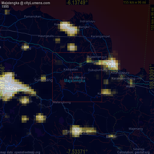
» NASA, Earths city lights 1995
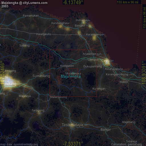
» NASA city lights 2003
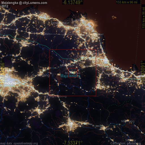
» Earth at Night: Flat Maps 2012, 2016