Genteng night lights from space
Night Light of Genteng (East Java) from space (Indonesia) Src. Average luminocity for 10x10km area is 32.6488% and for 50x50km: 14.2142%.
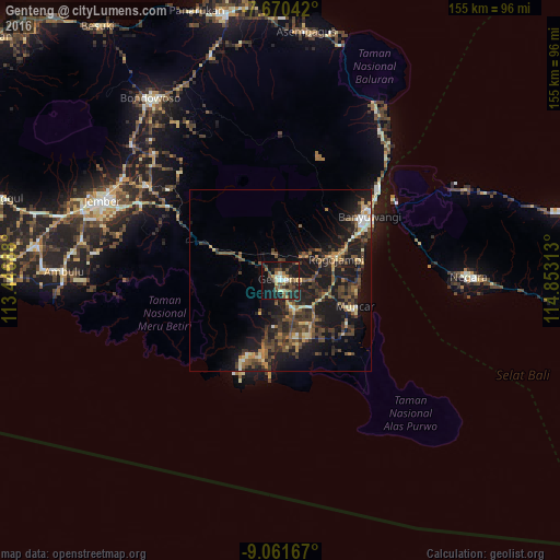
Analysis of Genteng night lights 2016
Square area 10x10 km:
 0.62%
0.62%90-99
5.99%80-89
3.1%70-79
3.31%60-69
5.58%50-59
4.13%40-49
9.92%30-39
6.61%20-29
12.6%10-19
37.19%0-9
10.95%Square area 50x50 km:
0.28%90-99
1.39%80-89
1.48%70-79
1.65%60-69
2.04%50-59
2.34%40-49
4.55%30-39
3.61%20-29
5.38%10-19
15.56%0-9
61.73%Clear (daylight) street map image can be seen on geolist.org.
Map coordinates:
7° 40' 13.5" South, 113° 26' 48.8" East
8° 22' 0" South, 114° 9' 0" East
9° 3' 42" South, 114° 51' 11.3" East
Some cities around Genteng sort by population:
• Jember
54.1 km =33.6 mi,  293°
293°
• Banyuwangi
27.3 km =17 mi,  56°
56°
• Muncar
21.5 km =13.4 mi,  110°
110°
• Srono
13.4 km =8.3 mi, 106°
• Negara
51.4 km =31.9 mi,  88°
88°
• Singojuruh
10.7 km =6.6 mi, 58°
• Wongsorejo
50.1 km =31.1 mi,  33°
33°
• Gambiran Satu
3.1 km =1.9 mi,  187°
187°
1644178 (p: 79,652)
Sources (retrieved 2019-11-25):
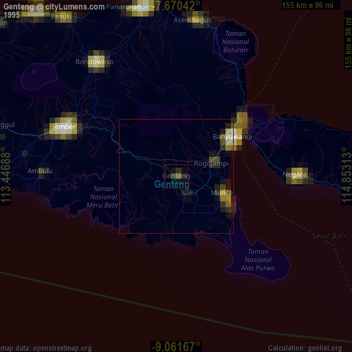
» NASA, Earths city lights 1995
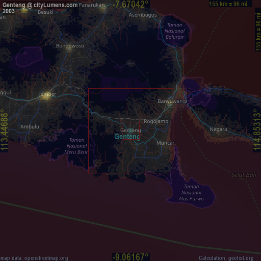
» NASA city lights 2003
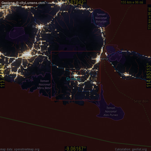
» Earth at Night: Flat Maps 2012, 2016