Tárnok night lights from space
Night Light of Tárnok (Pest) from space (Hungary) Src. Average luminocity for 10x10km area is 17.6652% and for 50x50km: 22.774%.
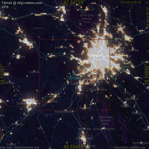
Analysis of Tárnok night lights 2016
Square area 10x10 km:
 0.15%
0.15%90-99
1.49%80-89
1.93%70-79
1.79%60-69
1.19%50-59
4.32%40-49
7.74%30-39
2.08%20-29
6.85%10-19
20.54%0-9
51.93%Square area 50x50 km:
8.77%90-99
4.03%80-89
1.46%70-79
1.74%60-69
2.1%50-59
2.31%40-49
3.17%30-39
3.01%20-29
3.7%10-19
6.2%0-9
63.5%Clear (daylight) street map image can be seen on geolist.org.
Map coordinates:
47° 50' 50.2" North, 18° 8' 33.6" East
47° 22' 23.8" North, 18° 50' 44.8" East
46° 53' 41.8" North, 19° 32' 56.1" East
Some cities around Tárnok sort by population:
• Érd
5.6 km =3.5 mi,  64°
64°
• Százhalombatta
8.5 km =5.3 mi,  124°
124°
• Törökbálint
8.1 km =5 mi,  39°
39°
• Tököl
10.5 km =6.5 mi, 123°
• Biatorbágy
11 km =6.8 mi,  349°
349°
• Halásztelek
10.3 km =6.4 mi,  97°
97°
• Diósd
8.7 km =5.4 mi, 62°
• Martonvásár
7.6 km =4.7 mi,  213°
213°
3044103 (p: 7,990)
Sources (retrieved 2019-11-25):
» Earth at Night: Flat Maps 2012, 2016