Elek night lights from space
Night Light of Elek (Bekes) from space (Hungary) Src. Average luminocity for 10x10km area is 0.3494% and for 50x50km: 2.4414%.
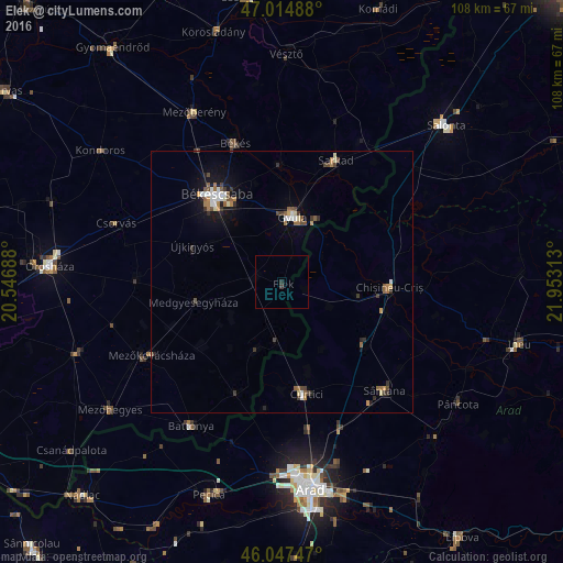
Analysis of Elek night lights 2016
Square area 10x10 km:
 0%
0%90-99
0%80-89
0%70-79
0%60-69
0%50-59
0%40-49
0%30-39
0.57%20-29
0.57%10-19
0%0-9
98.86%Square area 50x50 km:
0.3%90-99
0.31%80-89
0.19%70-79
0.23%60-69
0.4%50-59
0.44%40-49
0.36%30-39
0.45%20-29
0.35%10-19
1.36%0-9
95.61%Clear (daylight) street map image can be seen on geolist.org.
Map coordinates:
47° 0' 53.6" North, 20° 32' 48.8" East
46° 31' 60" North, 21° 15' 0" East
46° 2' 50.9" North, 21° 57' 11.3" East
Some cities around Elek sort by population:
• Békéscsaba
20.2 km =12.6 mi,  325°
325°
• Gyula
13.2 km =8.2 mi,  11°
11°
• Békés
27.4 km =17 mi,  341°
341°
• Sarkad
26.2 km =16.3 mi,  22°
22°
• Curtici, RO
20.7 km =12.9 mi,  169°
169°
• Chişineu-Criş, RO
20.6 km =12.8 mi,  92°
92°
• Macea, RO
17.1 km =10.6 mi, 167°
• Újkígyós
17.5 km =10.9 mi,  288°
288°
721189 (p: 5,465)
Sources (retrieved 2019-11-25):
» Earth at Night: Flat Maps 2012, 2016