Split night lights from space
Night Light of Split (Split-Dalmatia) from space (Croatia) Src. Average luminocity for 10x10km area is 48.373% and for 50x50km: 10.502%.
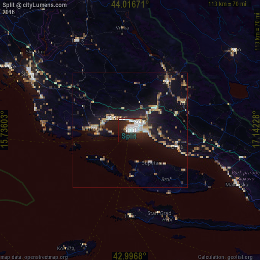
Analysis of Split night lights 2016
Square area 10x10 km:
 17.62%
90-99
16.19%80-89
1.75%70-79
0.95%60-69
0.95%50-59
2.7%40-49
1.59%30-39
3.49%20-29
18.25%10-19
26.19%0-9
10.32%Square area 50x50 km:
1.19%90-99
1.72%80-89
1.13%70-79
1.11%60-69
1%50-59
1.49%40-49
1.54%30-39
1.08%20-29
2.8%10-19
9.8%0-9
77.15%Clear (daylight) street map image can be seen on geolist.org.
Map coordinates:
44° 1' 0.2" North, 15° 44' 9.7" East
43° 30' 32.1" North, 16° 26' 20.9" East
42° 59' 48.5" North, 17° 8' 32.2" East
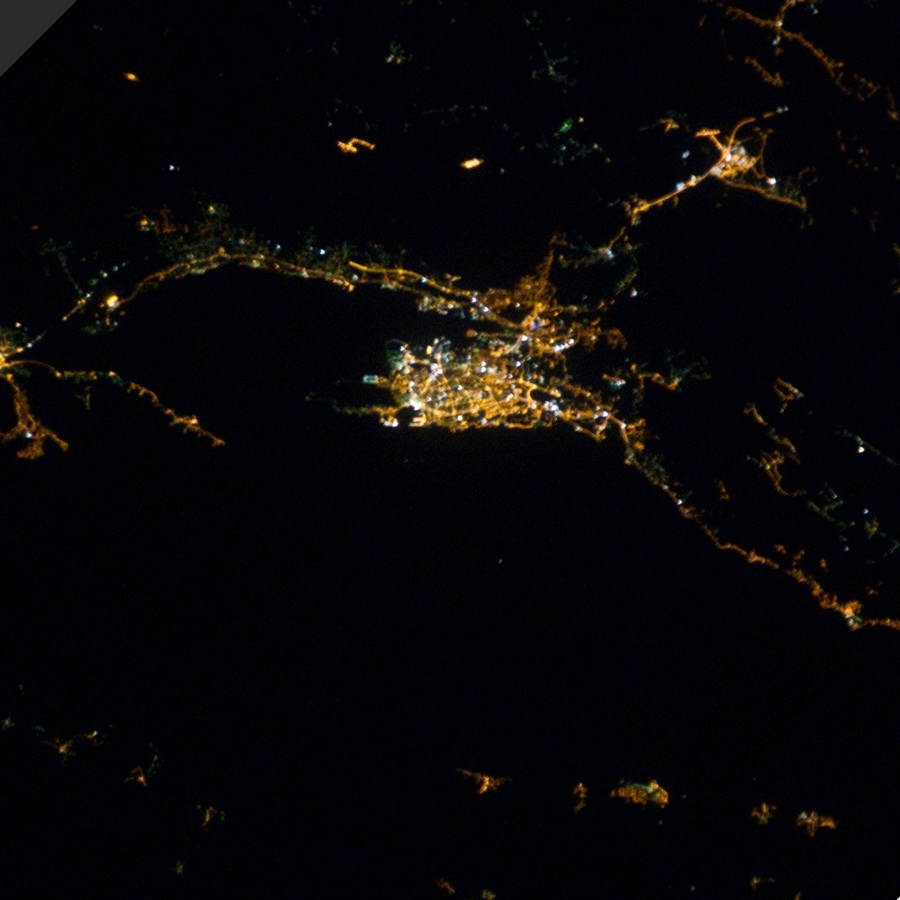
Fantastic image of Split from space taken by astronauts [src2], but I don't have information about it's orientation, scale or angle. If necessary, it was rotated manually, so North points approximately to upper direction. Click to zoom in:
Some cities around Split sort by population:
• Solin
5.8 km =3.6 mi,  48°
48°
• Trogir
15.1 km =9.4 mi,  271°
271°
• Podstrana
9.3 km =5.8 mi,  105°
105°
• Kaštel Stari
8.5 km =5.3 mi,  302°
302°
• Omiš
21.4 km =13.3 mi, 109°
• Kaštel Novi
9.7 km =6 mi, 298°
• Kaštel Lukšić
7.7 km =4.8 mi,  311°
311°
• Kaštel Kambelovac
6.4 km =4 mi,  315°
315°
3190261 (p: 176,314)
Sources (retrieved 2019-11-25):
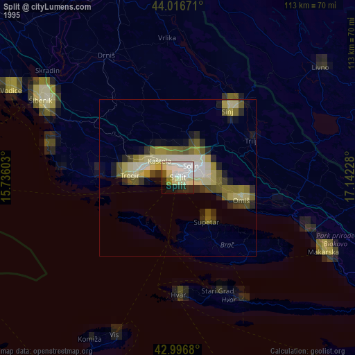
» NASA, Earths city lights 1995
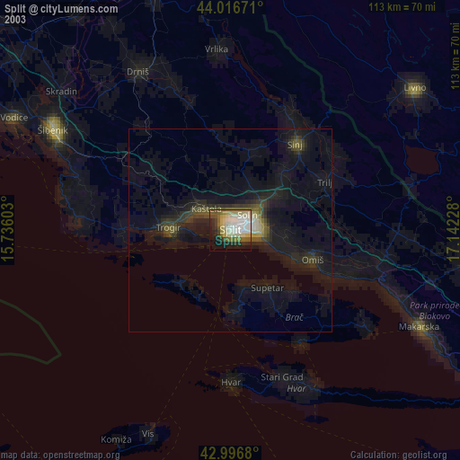
» NASA city lights 2003
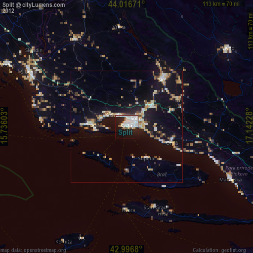
» Earth at Night: Flat Maps 2012, 2016
Src.2: by NASA Photo ID ISS026-E-28847, 2011-02-22