Bubaque night lights from space
Night Light of Bubaque (Bolama) from space (Guinea-Bissau) Src. Average luminocity for 10x10km area is 0.4892% and for 50x50km: 0.0197%.
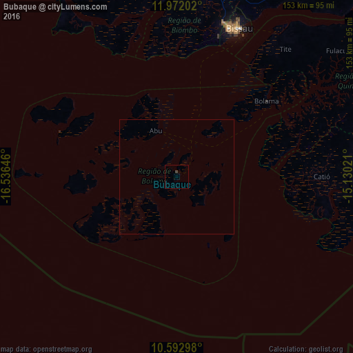
Analysis of Bubaque night lights 2016
Square area 10x10 km:
 0%
0%90-99
0%80-89
0%70-79
0%60-69
0%50-59
0%40-49
0.87%30-39
0%20-29
0%10-19
0%0-9
99.13%Square area 50x50 km:
0%90-99
0%80-89
0%70-79
0%60-69
0%50-59
0%40-49
0.03%30-39
0%20-29
0%10-19
0%0-9
99.97%Clear (daylight) street map image can be seen on geolist.org.
Map coordinates:
11° 58' 19.3" North, 16° 32' 11.3" West
11° 16' 60" North, 15° 49' 60" West
10° 35' 34.7" North, 15° 7' 48.8" West
Some cities around Bubaque sort by population:
• Bissau
69.4 km =43.1 mi,  21°
21°
• Bolama
50.8 km =31.6 mi,  50°
50°
• Catió
63.1 km =39.2 mi,  90°
90°
• Mansôa
104.2 km =64.7 mi,  32°
32°
• Buba
97.4 km =60.5 mi,  69°
69°
• Quebo
98.3 km =61.1 mi, 86°
• Canchungo
89.8 km =55.8 mi,  345°
345°
• Quinhámel
67.2 km =41.8 mi,  357°
357°
2374583 (p: 9,244)
Sources (retrieved 2019-11-25):
» Earth at Night: Flat Maps 2012, 2016