San Sebastián night lights from space
Night Light of San Sebastián (Retalhuleu) from space (Guatemala) Src. Average luminocity for 10x10km area is 35% and for 50x50km: 5.1786%.
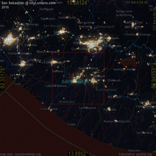
Analysis of San Sebastián night lights 2016
Square area 10x10 km:
 0.65%
0.65%90-99
4.76%80-89
7.58%70-79
3.46%60-69
7.14%50-59
3.68%40-49
10.39%30-39
8.01%20-29
7.79%10-19
32.47%0-9
14.07%Square area 50x50 km:
0.02%90-99
0.41%80-89
0.73%70-79
0.72%60-69
0.7%50-59
0.7%40-49
1.02%30-39
1.32%20-29
1.31%10-19
4.5%0-9
88.56%Clear (daylight) street map image can be seen on geolist.org.
Map coordinates:
15° 14' 28.5" North, 92° 21' 6.4" West
14° 33' 42.4" North, 91° 38' 55.1" West
13° 52' 48.7" North, 90° 56' 43.9" West
Some cities around San Sebastián sort by population:
• Retalhuleu
4.2 km =2.6 mi,  227°
227°
• Nuevo San Carlos
6 km =3.7 mi,  305°
305°
• El Palmar
12.5 km =7.8 mi,  37°
37°
• San Francisco Zapotitlán
14 km =8.7 mi,  77°
77°
• Cuyotenango
8.6 km =5.3 mi,  106°
106°
• San Felipe
8.9 km =5.5 mi, 40°
• El Asintal
9.3 km =5.8 mi,  294°
294°
• San Andrés Villa Seca
7 km =4.3 mi, 75°
3589548 (p: 14,823)
Sources (retrieved 2019-11-25):
» Earth at Night: Flat Maps 2012, 2016