Retalhuleu night lights from space
Night Light of Retalhuleu from space (Guatemala) Src. Average luminocity for 10x10km area is 29.4437% and for 50x50km: 5.0779%.
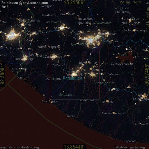
Analysis of Retalhuleu night lights 2016
Square area 10x10 km:
 0.65%
0.65%90-99
4.33%80-89
5.84%70-79
3.03%60-69
7.58%50-59
3.9%40-49
6.28%30-39
5.41%20-29
4.33%10-19
21.86%0-9
36.8%Square area 50x50 km:
0.02%90-99
0.41%80-89
0.7%70-79
0.74%60-69
0.7%50-59
0.7%40-49
1.03%30-39
1.27%20-29
1.38%10-19
4.2%0-9
88.84%Clear (daylight) street map image can be seen on geolist.org.
Map coordinates:
15° 12' 56.4" North, 92° 22' 51.3" West
14° 32' 10" North, 91° 40' 40" West
13° 51' 16.1" North, 90° 58' 28.8" West
Some cities around Retalhuleu sort by population:
• Nuevo San Carlos
6.6 km =4.1 mi,  344°
344°
• El Palmar
16.7 km =10.4 mi,  40°
40°
• San Sebastián
4.2 km =2.6 mi,  47°
47°
• San Francisco Zapotitlán
17.8 km =11.1 mi,  70°
70°
• Cuyotenango
11.4 km =7.1 mi,  87°
87°
• San Felipe
13.1 km =8.1 mi, 42°
• El Asintal
8.6 km =5.3 mi,  321°
321°
• San Andrés Villa Seca
11 km =6.8 mi,  64°
64°
3590858 (p: 36,656)
Sources (retrieved 2019-11-25):
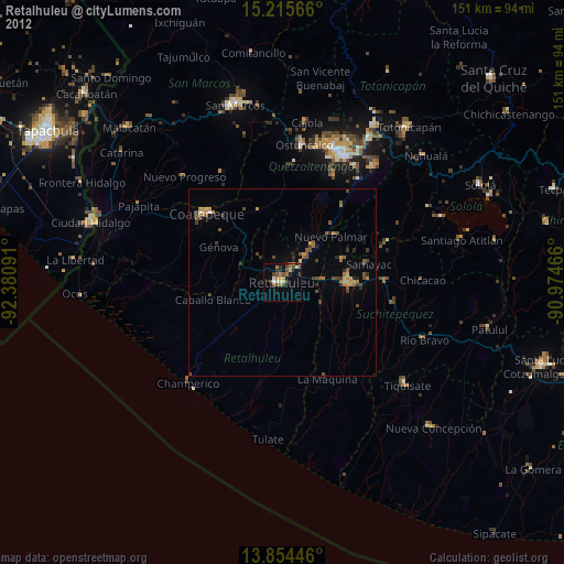
» Earth at Night: Flat Maps 2012, 2016