Cuyotenango night lights from space
Night Light of Cuyotenango (Suchitepeque) from space (Guatemala) Src. Average luminocity for 10x10km area is 12.6623% and for 50x50km: 4.4192%.
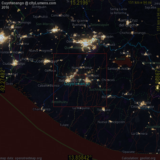
Analysis of Cuyotenango night lights 2016
Square area 10x10 km:
 0%
0%90-99
0%80-89
0.43%70-79
1.08%60-69
1.52%50-59
1.73%40-49
1.3%30-39
3.68%20-29
6.28%10-19
20.78%0-9
63.2%Square area 50x50 km:
0.02%90-99
0.25%80-89
0.62%70-79
0.58%60-69
0.68%50-59
0.7%40-49
0.87%30-39
1.11%20-29
1.19%10-19
3.91%0-9
90.06%Clear (daylight) street map image can be seen on geolist.org.
Map coordinates:
15° 13' 10.6" North, 92° 16' 29.7" West
14° 32' 24.2" North, 91° 34' 18.4" West
13° 51' 30.3" North, 90° 52' 7.2" West
Some cities around Cuyotenango sort by population:
• Mazatenango
7.4 km =4.6 mi,  95°
95°
• Retalhuleu
11.4 km =7.1 mi,  267°
267°
• San Sebastián
8.6 km =5.3 mi,  286°
286°
• San Francisco Zapotitlán
7.7 km =4.8 mi,  44°
44°
• San Felipe
9.6 km =6 mi,  344°
344°
• Santo Domingo Suchitepéquez
11.7 km =7.3 mi,  125°
125°
• San Bernardino
12.2 km =7.6 mi,  88°
88°
• San Andrés Villa Seca
4.5 km =2.8 mi, 340°
3597750 (p: 10,825)
Sources (retrieved 2019-11-25):
» Earth at Night: Flat Maps 2012, 2016