San Pablo Jocopilas night lights from space
Night Light of San Pablo Jocopilas (Suchitepeque) from space (Guatemala) Src. Average luminocity for 10x10km area is 10.4221% and for 50x50km: 4.8766%.
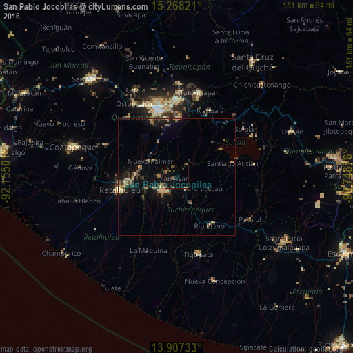

Analysis of San Pablo Jocopilas night lights 2016
Square area 10x10 km:
 0%
0%90-99
0%80-89
0.43%70-79
0.43%60-69
1.08%50-59
3.46%40-49
2.38%30-39
5.19%20-29
1.73%10-19
12.99%0-9
72.29%Square area 50x50 km:
0.02%90-99
0.17%80-89
0.7%70-79
0.7%60-69
0.93%50-59
0.62%40-49
1.08%30-39
1.18%20-29
1.38%10-19
4.64%0-9
88.58%Clear (daylight) street map image can be seen on geolist.org.
Map coordinates:
15° 16' 5.6" North, 92° 9' 18" West
14° 35' 19.8" North, 91° 27' 6.8" West
13° 54' 26.4" North, 90° 44' 55.5" West
Some cities around San Pablo Jocopilas sort by population:
• Mazatenango
8.2 km =5.1 mi,  222°
222°
• San Francisco Zapotitlán
7.5 km =4.7 mi,  270°
270°
• San Antonio Suchitepéquez
6.8 km =4.2 mi,  143°
143°
• Cuyotenango
14 km =8.7 mi,  247°
247°
• Samayac
1.4 km =0.9 mi,  228°
228°
• Santo Tomás La Unión
6.5 km =4 mi,  42°
42°
• Santo Domingo Suchitepéquez
12.7 km =7.9 mi,  195°
195°
• San Bernardino
5.2 km =3.2 mi,  187°
187°
3589671 (p: 20,259)
Sources (retrieved 2019-11-25):
» Earth at Night: Flat Maps 2012, 2016