Soúda night lights from space
Night Light of Soúda (Crete) from space (Greece) Src. Average luminocity for 10x10km area is 42.37% and for 50x50km: 6.654%.
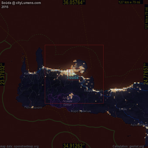
Analysis of Soúda night lights 2016
Square area 10x10 km:
 3.11%
3.11%90-99
5.68%80-89
8.97%70-79
9.89%60-69
10.62%50-59
0.55%40-49
4.21%30-39
3.11%20-29
16.3%10-19
28.94%0-9
8.61%Square area 50x50 km:
0.26%90-99
0.58%80-89
1.04%70-79
1.11%60-69
1.62%50-59
0.49%40-49
0.71%30-39
1.37%20-29
2.07%10-19
5.37%0-9
85.39%Clear (daylight) street map image can be seen on geolist.org.
Map coordinates:
36° 3' 27.5" North, 23° 22' 13.2" East
35° 29' 13.8" North, 24° 4' 24.4" East
34° 54' 45.4" North, 24° 46' 35.7" East
Some cities around Soúda sort by population:
• Irákleion
98.6 km =61.3 mi,  100°
100°
• Chaniá
4.8 km =3 mi,  303°
303°
• Rethymno
39.4 km =24.5 mi,  110°
110°
• Gázi
91.8 km =57 mi, 101°
• Néa Alikarnassós
99.7 km =62 mi, 99°
• Moíres
87.3 km =54.2 mi,  123°
123°
• Mourniés
5.5 km =3.4 mi,  264°
264°
• Tympáki
78.1 km =48.5 mi,  126°
126°
253456 (p: 6,729)
Sources (retrieved 2019-11-25):
» Earth at Night: Flat Maps 2012, 2016