Aridaía night lights from space
Night Light of Aridaía (Central Macedonia) from space (Greece) Src. Average luminocity for 10x10km area is 8.1139% and for 50x50km: 2.4364%.
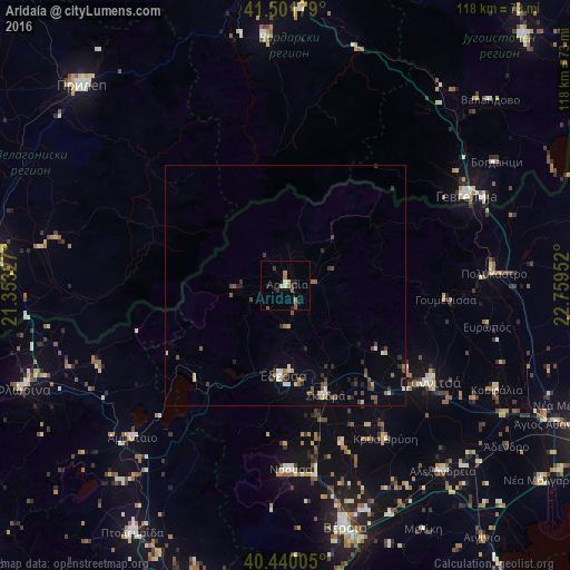
Analysis of Aridaía night lights 2016
Square area 10x10 km:
 0.51%
0.51%90-99
0.17%80-89
0.68%70-79
2.04%60-69
1.02%50-59
2.55%40-49
0.68%30-39
1.19%20-29
2.89%10-19
0.85%0-9
87.41%Square area 50x50 km:
0.11%90-99
0.37%80-89
0.25%70-79
0.17%60-69
0.23%50-59
0.53%40-49
0.5%30-39
0.55%20-29
0.55%10-19
0.57%0-9
96.19%Clear (daylight) street map image can be seen on geolist.org.
Map coordinates:
41° 30' 6.4" North, 21° 21' 11.8" East
40° 58' 23" North, 22° 3' 23" East
40° 26' 24.2" North, 22° 45' 34.3" East
Some cities around Aridaía sort by population:
• Giannitsá
35.7 km =22.2 mi,  124°
124°
• Gevgelija, MK
41.8 km =26 mi,  63°
63°
• Náousa
38.2 km =23.7 mi,  178°
178°
• Édessa
19 km =11.8 mi, 182°
• Bogdanci, MK
50.5 km =31.4 mi, 59°
• Koufália
48.5 km =30.1 mi, 116°
• Polýkastro
43.1 km =26.8 mi,  86°
86°
• Krýa Vrýsi
38 km =23.6 mi,  146°
146°
736753 (p: 6,561)
Sources (retrieved 2019-11-25):
» Earth at Night: Flat Maps 2012, 2016