St Anne night lights from space
Night Light of St Anne (Alderney) from space (Guernsey) Src. Average luminocity for 10x10km area is 0% and for 50x50km: 0.1609%.
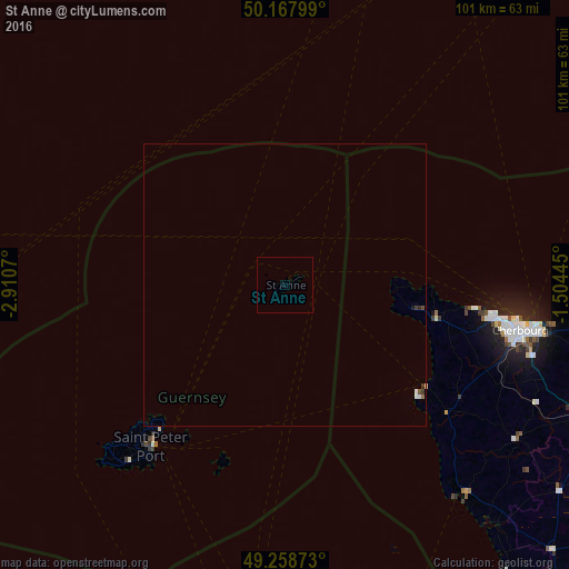
Analysis of St Anne night lights 2016
Square area 10x10 km:
 0%
0%90-99
0%80-89
0%70-79
0%60-69
0%50-59
0%40-49
0%30-39
0%20-29
0%10-19
0%0-9
100%Square area 50x50 km:
0.03%90-99
0.04%80-89
0.01%70-79
0%60-69
0.02%50-59
0%40-49
0.04%30-39
0.06%20-29
0.03%10-19
0.02%0-9
99.75%Clear (daylight) street map image can be seen on geolist.org.
Map coordinates:
50° 10' 4.8" North, 2° 54' 38.5" West
49° 42' 55.8" North, 2° 12' 27.3" West
49° 15' 31.4" North, 1° 30' 16" West
Some cities around St Anne sort by population:
• Équeurdreville-Hainneville, FR
40.6 km =25.2 mi,  100°
100°
• Octeville, FR
41.8 km =26 mi, 103°
• Saint Peter Port
37 km =23 mi,  219°
219°
• Querqueville, FR
37.6 km =23.4 mi, 99°
• Saint Andrew
40.4 km =25.1 mi, 221°
• St Martin
39.8 km =24.7 mi, 218°
• Castel
39.5 km =24.5 mi,  225°
225°
• Saint Sampson
34.4 km =21.4 mi, 221°
3042289 (p: 0)
Sources (retrieved 2019-11-25):
» Earth at Night: Flat Maps 2012, 2016