Saint-Mihiel night lights from space
Night Light of Saint-Mihiel (Grand Est) from space (France) Src. Average luminocity for 10x10km area is 5.7074% and for 50x50km: 1.7007%.
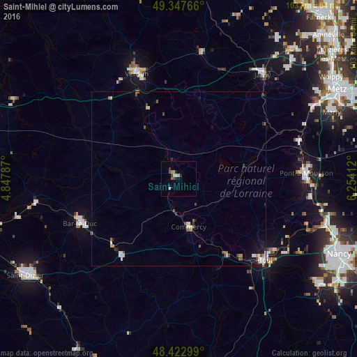
Analysis of Saint-Mihiel night lights 2016
Square area 10x10 km:
 0.71%
0.71%90-99
0.99%80-89
0.71%70-79
0.71%60-69
0.43%50-59
0.71%40-49
1.28%30-39
0.71%20-29
1.14%10-19
0.99%0-9
91.62%Square area 50x50 km:
0.2%90-99
0.39%80-89
0.16%70-79
0.13%60-69
0.15%50-59
0.23%40-49
0.34%30-39
0.19%20-29
0.19%10-19
0.63%0-9
97.39%Clear (daylight) street map image can be seen on geolist.org.
Map coordinates:
49° 20' 51.6" North, 4° 50' 52.3" East
48° 53' 14.9" North, 5° 33' 3.6" East
48° 25' 22.8" North, 6° 15' 14.8" East
Some cities around Saint-Mihiel sort by population:
• Verdun
32.7 km =20.3 mi,  337°
337°
• Bar-le-Duc
31.3 km =19.4 mi,  245°
245°
• Toul
33.9 km =21.1 mi,  132°
132°
• Pont-à-Mousson
37 km =23 mi,  86°
86°
• Jarny
38.4 km =23.9 mi,  38°
38°
• Commercy
14.3 km =8.9 mi,  168°
168°
• Ligny-en-Barrois
27.6 km =17.1 mi,  216°
216°
• Blénod-lès-Pont-à-Mousson
36.4 km =22.6 mi, 90°
2977948 (p: 5,325)
Sources (retrieved 2019-11-25):
» Earth at Night: Flat Maps 2012, 2016