Orthez night lights from space
Night Light of Orthez (Nouvelle-Aquitaine) from space (France) Src. Average luminocity for 10x10km area is 6.1254% and for 50x50km: 3.0276%.
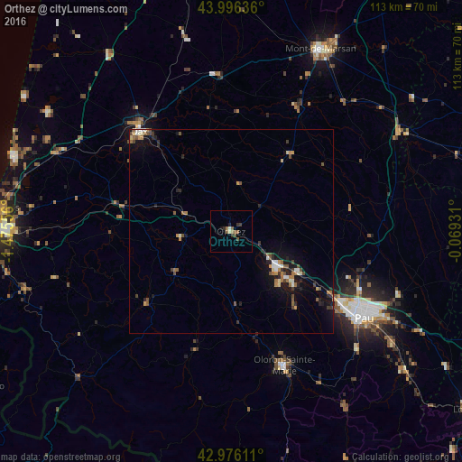
Analysis of Orthez night lights 2016
Square area 10x10 km:
 0%
0%90-99
0.79%80-89
0.48%70-79
0%60-69
1.43%50-59
2.38%40-49
1.59%30-39
1.75%20-29
1.11%10-19
0.63%0-9
89.84%Square area 50x50 km:
0.16%90-99
0.41%80-89
0.24%70-79
0.3%60-69
0.53%50-59
0.63%40-49
0.57%30-39
0.42%20-29
0.73%10-19
2.23%0-9
93.77%Clear (daylight) street map image can be seen on geolist.org.
Map coordinates:
43° 59' 46.9" North, 1° 28' 32" West
43° 29' 18.2" North, 0° 46' 20.8" West
42° 58' 34" North, 0° 4' 9.5" West
Some cities around Orthez sort by population:
• Dax
33.5 km =20.8 mi,  317°
317°
• Billère
36.7 km =22.8 mi,  124°
124°
• Lons
35.6 km =22.1 mi, 122°
• Oloron-Sainte-Marie
35.2 km =21.9 mi,  158°
158°
• Saint-Paul-lès-Dax
34.8 km =21.6 mi, 319°
• Lescar
33.5 km =20.8 mi, 120°
• Mourenx
18.2 km =11.3 mi,  129°
129°
• Salies-de-Béarn
12.4 km =7.7 mi,  262°
262°
2989187 (p: 11,857)
Sources (retrieved 2019-11-25):
» Earth at Night: Flat Maps 2012, 2016