Montpellier night lights from space
Night Light of Montpellier (Occitanie) from space (France) Src. Average luminocity for 10x10km area is 91.4136% and for 50x50km: 22.3927%.
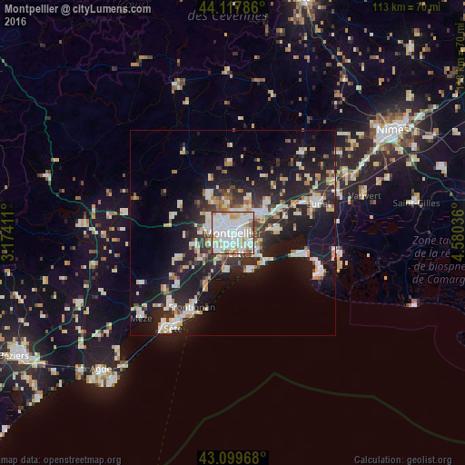

Analysis of Montpellier night lights 2016
Square area 10x10 km:
 45.45%
90-99
28.48%80-89
6.36%70-79
8.79%60-69
5.91%50-59
4.24%40-49
0.76%30-39
0%20-29
0%10-19
0%0-9
0%Square area 50x50 km:
4.27%90-99
4.86%80-89
2.4%70-79
2.3%60-69
2.31%50-59
1.54%40-49
1.78%30-39
2.87%20-29
7.91%10-19
18.52%0-9
51.23%Clear (daylight) street map image can be seen on geolist.org.
Map coordinates:
44° 7' 4.3" North, 3° 10' 26.8" East
43° 36' 39.3" North, 3° 52' 38" East
43° 5' 58.8" North, 4° 34' 49.3" East
Some cities around Montpellier sort by population:
• Castelnau-le-Lez
3.1 km =1.9 mi,  36°
36°
• Lattes
5.3 km =3.3 mi,  155°
155°
• Saint-Jean-de-Védas
5.5 km =3.4 mi,  228°
228°
• Le Crès
6.5 km =4 mi,  50°
50°
• Juvignac
5.4 km =3.4 mi,  273°
273°
• Grabels
7.5 km =4.7 mi,  303°
303°
• Clapiers
5.4 km =3.4 mi,  10°
10°
• Jacou
6.3 km =3.9 mi,  26°
26°
2992166 (p: 248,252)
Sources (retrieved 2019-11-25):
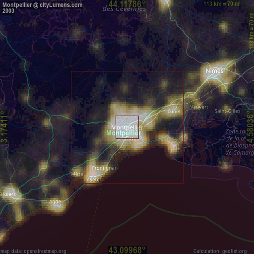
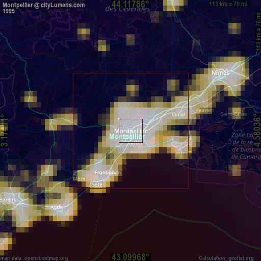
» NASA, Earths city lights 1995
» NASA city lights 2003
» Earth at Night: Flat Maps 2012, 2016