Molsheim night lights from space
Night Light of Molsheim (Grand Est) from space (France) Src. Average luminocity for 10x10km area is 35.7991% and for 50x50km: 19.3037%.
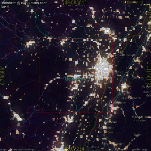
Analysis of Molsheim night lights 2016
Square area 10x10 km:
 6.1%
6.1%90-99
8.48%80-89
1.93%70-79
2.38%60-69
4.17%50-59
2.98%40-49
2.23%30-39
4.32%20-29
21.73%10-19
40.92%0-9
4.76%Square area 50x50 km:
4.43%90-99
4.13%80-89
1.4%70-79
1.41%60-69
1.58%50-59
1.78%40-49
1.96%30-39
2.89%20-29
5.45%10-19
14.6%0-9
60.37%Clear (daylight) street map image can be seen on geolist.org.
Map coordinates:
49° 0' 13.7" North, 6° 47' 19.9" East
48° 32' 25.5" North, 7° 29' 31.2" East
48° 4' 21.9" North, 8° 11' 42.4" East
Some cities around Molsheim sort by population:
• Lingolsheim
14.2 km =8.8 mi,  82°
82°
• Obernai
8.6 km =5.3 mi,  185°
185°
• Ostwald
16.1 km =10 mi,  88°
88°
• Geispolsheim
11.8 km =7.3 mi,  103°
103°
• Barr
15.1 km =9.4 mi, 192°
• Mutzig
2.7 km =1.7 mi,  268°
268°
• Eckbolsheim
15.1 km =9.4 mi,  72°
72°
• Wasselonne
11.4 km =7.1 mi,  342°
342°
2993476 (p: 9,953)
Sources (retrieved 2019-11-25):
» Earth at Night: Flat Maps 2012, 2016