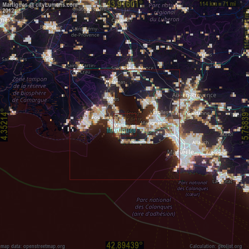
Martigues night lights from space
Night Light of Martigues (Provence-Alpes-Côte d'Azur) from space (France) Src. Average luminocity for 10x10km area is 50.246% and for 50x50km: 22.8466%.
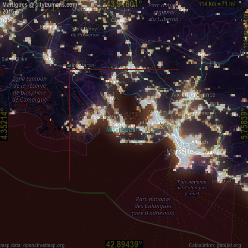
Analysis of Martigues night lights 2016
Square area 10x10 km:
 14.29%
90-99
14.13%80-89
2.22%70-79
2.38%60-69
1.11%50-59
7.46%40-49
5.56%30-39
9.68%20-29
20.95%10-19
20.63%0-9
1.59%Square area 50x50 km:
3.81%90-99
4.91%80-89
2.39%70-79
2.08%60-69
1.76%50-59
2.56%40-49
2.42%30-39
4%20-29
10.31%10-19
16.72%0-9
49.05%Clear (daylight) street map image can be seen on geolist.org.
Map coordinates:
43° 54' 57.6" North, 4° 21' 7.7" East
43° 24' 26.5" North, 5° 3' 18.9" East
42° 53' 39.8" North, 5° 45' 30.2" East
Some cities around Martigues sort by population:
• Marignane
12.9 km =8 mi,  85°
85°
• Fos-sur-Mer
9.6 km =6 mi,  290°
290°
• Port-de-Bouc
6 km =3.7 mi,  269°
269°
• Berre-l'Étang
12.2 km =7.6 mi,  49°
49°
• Châteauneuf-les-Martigues
9.2 km =5.7 mi,  106°
106°
• Sausset-les-Pins
9.3 km =5.8 mi,  154°
154°
• Carry-le-Rouet
11.5 km =7.1 mi,  137°
137°
• Saint-Mitre-les-Remparts
6.2 km =3.9 mi,  328°
328°
2995387 (p: 45,749)
Sources (retrieved 2019-11-25):
» Earth at Night: Flat Maps 2012, 2016