Marignane night lights from space
Night Light of Marignane (Provence-Alpes-Côte d'Azur) from space (France) Src. Average luminocity for 10x10km area is 65.0381% and for 50x50km: 33.5457%.
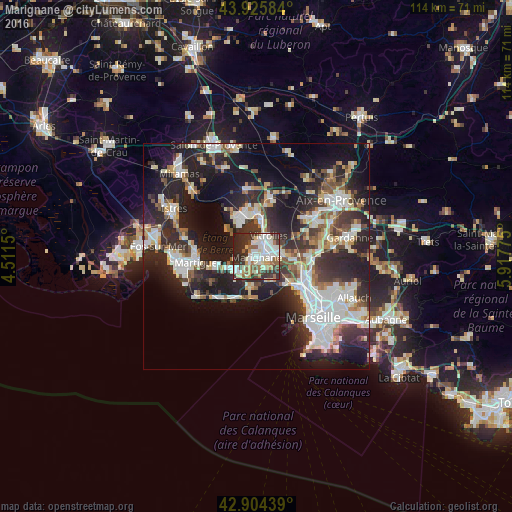
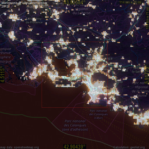
Analysis of Marignane night lights 2016
Square area 10x10 km:
 16.98%
90-99
18.89%80-89
7.3%70-79
4.6%60-69
4.92%50-59
9.52%40-49
4.76%30-39
16.35%20-29
15.08%10-19
1.59%0-9
0%Square area 50x50 km:
7.45%90-99
7.35%80-89
3.18%70-79
2.75%60-69
2.82%50-59
3.9%40-49
3.59%30-39
6.09%20-29
13.7%10-19
17.42%0-9
31.74%Clear (daylight) street map image can be seen on geolist.org.
Map coordinates:
43° 55' 33" North, 4° 30' 41.4" East
43° 25' 2.2" North, 5° 12' 52.6" East
42° 54' 15.8" North, 5° 55' 3.9" East
Some cities around Marignane sort by population:
• Vitrolles
5.5 km =3.4 mi,  30°
30°
• Les Pennes-Mirabeau
7.6 km =4.7 mi,  95°
95°
• Berre-l'Étang
7.6 km =4.7 mi,  332°
332°
• Rognac
8 km =5 mi,  11°
11°
• Châteauneuf-les-Martigues
5.5 km =3.4 mi,  227°
227°
• Gignac-la-Nerthe
3.2 km =2 mi,  147°
147°
• Saint-Victoret
1.6 km =1 mi,  80°
80°
• L'Estaque
9.6 km =6 mi,  128°
128°
2995750 (p: 35,873)
Sources (retrieved 2019-11-25):
» Earth at Night: Flat Maps 2012, 2016