Marseille 14 night lights from space
Night Light of Marseille 14 (Provence-Alpes-Côte d'Azur) from space (France) Src. Average luminocity for 10x10km area is 78.2714% and for 50x50km: 31.5129%.
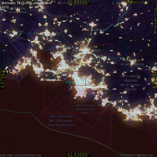

Analysis of Marseille 14 night lights 2016
Square area 10x10 km:
 40.95%
90-99
19.21%80-89
0.63%70-79
3.49%60-69
6.03%50-59
4.92%40-49
7.46%30-39
11.9%20-29
5.24%10-19
0.16%0-9
0%Square area 50x50 km:
6.86%90-99
6.65%80-89
3.14%70-79
2.58%60-69
3.06%50-59
3.49%40-49
3.62%30-39
5.96%20-29
11.73%10-19
17.19%0-9
35.72%Clear (daylight) street map image can be seen on geolist.org.
Map coordinates:
43° 51' 13.2" North, 4° 40' 36.9" East
43° 20' 40.1" North, 5° 22' 48.1" East
42° 49' 51.5" North, 6° 4' 59.4" East
Some cities around Marseille 14 sort by population:
• La Cabucelle
2.1 km =1.3 mi,  227°
227°
• Saint-Louis
2.1 km =1.3 mi,  281°
281°
• Le Merlan
2.3 km =1.4 mi,  105°
105°
• Le Canet
2.1 km =1.3 mi,  197°
197°
• Les Aygalades
1.6 km =1 mi,  332°
332°
• La Delorme
0.6 km =0.4 mi,  265°
265°
• Les Arnavaux
1 km =0.6 mi,  181°
181°
• Saint-Joseph
0.2 km =0.1 mi,  353°
353°
7284895 (p: 61,920)
Sources (retrieved 2019-11-25):
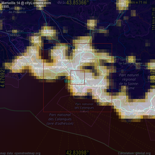
» NASA, Earths city lights 1995
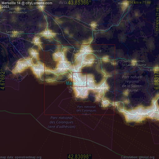
» NASA city lights 2003
» Earth at Night: Flat Maps 2012, 2016