Marseille 04 night lights from space
Night Light of Marseille 04 (Provence-Alpes-Côte d'Azur) from space (France) Src. Average luminocity for 10x10km area is 90.9076% and for 50x50km: 29.0333%.
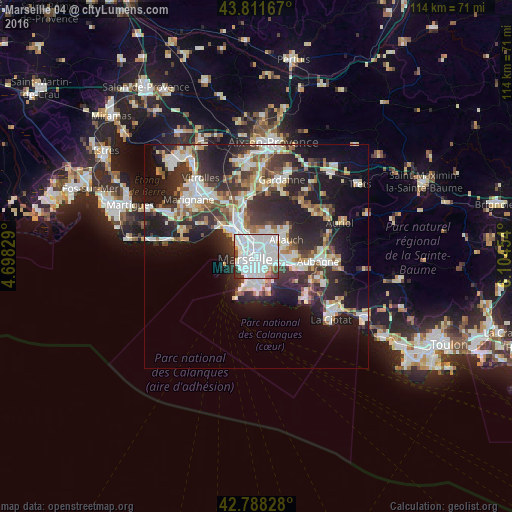
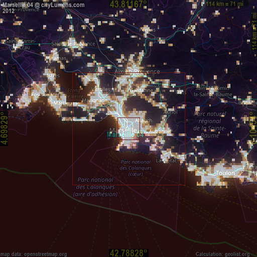
Analysis of Marseille 04 night lights 2016
Square area 10x10 km:
 58.48%
90-99
24.85%80-89
1.21%70-79
1.06%60-69
2.12%50-59
1.82%40-49
3.03%30-39
6.21%20-29
1.21%10-19
0%0-9
0%Square area 50x50 km:
6.61%90-99
6.43%80-89
2.94%70-79
2.2%60-69
2.81%50-59
2.97%40-49
3.23%30-39
5.44%20-29
10.29%10-19
14.91%0-9
42.16%Clear (daylight) street map image can be seen on geolist.org.
Map coordinates:
43° 48' 42" North, 4° 41' 53.8" East
43° 18' 7.7" North, 5° 24' 5.1" East
42° 47' 17.8" North, 6° 6' 16.3" East
Some cities around Marseille 04 sort by population:
• Le Camas
1 km =0.6 mi,  215°
215°
• La Blancarde
0.4 km =0.2 mi,  118°
118°
• Cinq Avenues
0.4 km =0.2 mi,  300°
300°
• Saint-Barnabé
1.3 km =0.8 mi,  100°
100°
• La Conception
1.3 km =0.8 mi,  207°
207°
• Chutes-Lavie
1 km =0.6 mi,  328°
328°
• Les Chartreux
1 km =0.6 mi,  15°
15°
• Saint-Pierre
1.1 km =0.7 mi,  157°
157°
7284885 (p: 47,193)
Sources (retrieved 2019-11-25):
» Earth at Night: Flat Maps 2012, 2016