Limoges night lights from space
Night Light of Limoges (Nouvelle-Aquitaine) from space (France) Src. Average luminocity for 10x10km area is 72.872% and for 50x50km: 6.8459%.
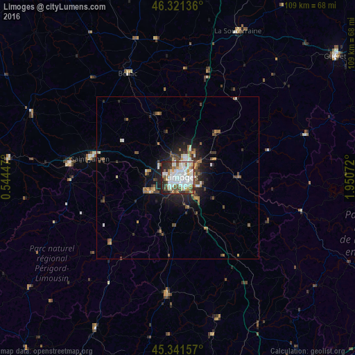
Analysis of Limoges night lights 2016
Square area 10x10 km:
 26.64%
90-99
23.96%80-89
3.42%70-79
5.8%60-69
6.55%50-59
7.59%40-49
6.25%30-39
4.46%20-29
10.71%10-19
4.61%0-9
0%Square area 50x50 km:
1.32%90-99
1.36%80-89
0.34%70-79
0.66%60-69
0.81%50-59
1.01%40-49
1.18%30-39
0.84%20-29
2.04%10-19
3.72%0-9
86.72%Clear (daylight) street map image can be seen on geolist.org.
Map coordinates:
46° 19' 16.9" North, 0° 32' 40.1" East
45° 50' 1" North, 1° 14' 51.3" East
45° 20' 29.7" North, 1° 57' 2.6" East
Some cities around Limoges sort by population:
• Saint-Junien
27.5 km =17.1 mi,  282°
282°
• Panazol
4.9 km =3 mi,  83°
83°
• Isle
3.6 km =2.2 mi,  207°
207°
• Couzeix
4.8 km =3 mi,  351°
351°
• Le Palais-sur-Vienne
6.8 km =4.2 mi,  60°
60°
• Aixe-sur-Vienne
9.6 km =6 mi,  244°
244°
• Feytiat
7 km =4.3 mi,  112°
112°
• Ambazac
18.1 km =11.2 mi,  40°
40°
2998286 (p: 141,176)
Sources (retrieved 2019-11-25):
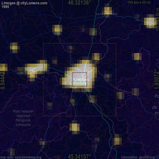
» NASA, Earths city lights 1995
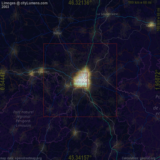
» NASA city lights 2003
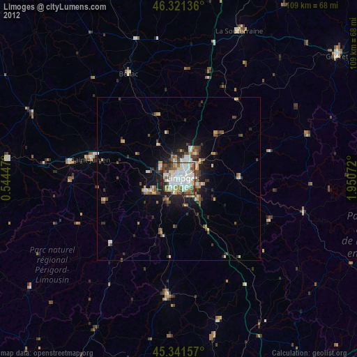
» Earth at Night: Flat Maps 2012, 2016