Le Palais-sur-Vienne night lights from space
Night Light of Le Palais-sur-Vienne (Nouvelle-Aquitaine) from space (France) Src. Average luminocity for 10x10km area is 50.7247% and for 50x50km: 6.631%.
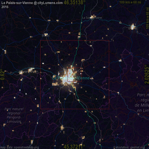
Analysis of Le Palais-sur-Vienne night lights 2016
Square area 10x10 km:
 15.77%
90-99
15.33%80-89
2.53%70-79
4.61%60-69
3.42%50-59
4.02%40-49
5.8%30-39
5.65%20-29
9.38%10-19
16.96%0-9
16.52%Square area 50x50 km:
1.32%90-99
1.33%80-89
0.32%70-79
0.64%60-69
0.74%50-59
0.96%40-49
1.14%30-39
0.78%20-29
2.05%10-19
3.79%0-9
86.94%Clear (daylight) street map image can be seen on geolist.org.
Map coordinates:
46° 21' 5" North, 0° 37' 12" East
45° 51' 50" North, 1° 19' 23.3" East
45° 22' 19.6" North, 2° 1' 34.5" East
Some cities around Le Palais-sur-Vienne sort by population:
• Limoges
6.8 km =4.2 mi,  240°
240°
• Saint-Junien
32.7 km =20.3 mi,  274°
274°
• Panazol
3 km =1.9 mi,  200°
200°
• Isle
10 km =6.2 mi,  228°
228°
• Couzeix
6.7 km =4.2 mi,  282°
282°
• Aixe-sur-Vienne
16.3 km =10.1 mi, 242°
• Feytiat
6 km =3.7 mi,  174°
174°
• Ambazac
12 km =7.5 mi,  29°
29°
3003044 (p: 5,944)
Sources (retrieved 2019-11-25):
» Earth at Night: Flat Maps 2012, 2016