Landerneau night lights from space
Night Light of Landerneau (Brittany) from space (France) Src. Average luminocity for 10x10km area is 9.3452% and for 50x50km: 5.11%.
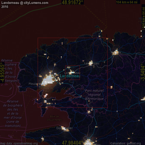
Analysis of Landerneau night lights 2016
Square area 10x10 km:
 0.57%
0.57%90-99
2.27%80-89
0.28%70-79
1.99%60-69
1.14%50-59
1.28%40-49
0.43%30-39
2.41%20-29
0.99%10-19
0.57%0-9
88.07%Square area 50x50 km:
0.98%90-99
1.15%80-89
0.25%70-79
0.4%60-69
0.6%50-59
0.46%40-49
0.5%30-39
0.57%20-29
1.67%10-19
3.17%0-9
90.24%Clear (daylight) street map image can be seen on geolist.org.
Map coordinates:
48° 55' 0.2" North, 4° 57' 20.3" West
48° 27' 9.1" North, 4° 15' 9.1" West
47° 59' 2.5" North, 3° 32' 57.8" West
Some cities around Landerneau sort by population:
• Brest
18.6 km =11.6 mi,  248°
248°
• Guipavas
10.8 km =6.7 mi,  259°
259°
• Plougastel-Daoulas
12.7 km =7.9 mi,  221°
221°
• Le Relecq-Kerhuon
11.6 km =7.2 mi,  244°
244°
• Landivisiau
14.9 km =9.3 mi,  65°
65°
• Plabennec
14 km =8.7 mi,  293°
293°
• Lesneven
14.3 km =8.9 mi,  339°
339°
• Gouesnou
15.6 km =9.7 mi,  270°
270°
3007874 (p: 16,052)
Sources (retrieved 2019-11-25):
» Earth at Night: Flat Maps 2012, 2016