Hirson night lights from space
Night Light of Hirson (Hauts-de-France) from space (France) Src. Average luminocity for 10x10km area is 8.3151% and for 50x50km: 1.72%.
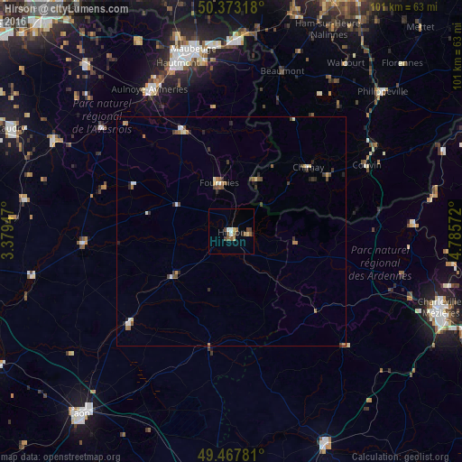
Analysis of Hirson night lights 2016
Square area 10x10 km:
 0.98%
0.98%90-99
0.7%80-89
1.12%70-79
0.56%60-69
1.54%50-59
2.1%40-49
1.68%30-39
0.84%20-29
1.4%10-19
0.28%0-9
88.8%Square area 50x50 km:
0.18%90-99
0.24%80-89
0.16%70-79
0.17%60-69
0.32%50-59
0.29%40-49
0.3%30-39
0.39%20-29
0.37%10-19
0.17%0-9
97.4%Clear (daylight) street map image can be seen on geolist.org.
Map coordinates:
50° 22' 23.4" North, 3° 22' 46.1" East
49° 55' 21.4" North, 4° 4' 57.3" East
49° 28' 4.1" North, 4° 47' 8.6" East
Some cities around Hirson sort by population:
• Fourmies
10.6 km =6.6 mi,  346°
346°
• Couvin, BE
32.8 km =20.4 mi,  63°
63°
• Chimay, BE
21.8 km =13.5 mi,  50°
50°
• Aulnoye-Aymeries
35.6 km =22.1 mi,  330°
330°
• Beaumont, BE
36.7 km =22.8 mi,  17°
17°
• Guise
32.6 km =20.3 mi,  265°
265°
• Ferrière-la-Grande
37.5 km =23.3 mi, 350°
• Momignies, BE
13 km =8.1 mi,  26°
26°
3013258 (p: 11,133)
Sources (retrieved 2019-11-25):
» Earth at Night: Flat Maps 2012, 2016