Corte night lights from space
Night Light of Corte (Corsica) from space (France) Src. Average luminocity for 10x10km area is 4.3394% and for 50x50km: 0.6852%.
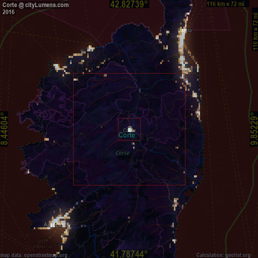
Analysis of Corte night lights 2016
Square area 10x10 km:
 1.06%
1.06%90-99
0.76%80-89
0.61%70-79
0%60-69
0%50-59
0.3%40-49
1.52%30-39
1.21%20-29
0%10-19
0%0-9
94.55%Square area 50x50 km:
0.07%90-99
0.09%80-89
0.06%70-79
0%60-69
0.13%50-59
0.15%40-49
0.2%30-39
0.08%20-29
0.1%10-19
0.43%0-9
98.7%Clear (daylight) street map image can be seen on geolist.org.
Map coordinates:
42° 49' 38.6" North, 8° 26' 45.7" East
42° 18' 34.4" North, 9° 8' 57" East
41° 47' 14.8" North, 9° 51' 8.2" East
Some cities around Corte sort by population:
• Ajaccio
55.1 km =34.2 mi,  217°
217°
• Bastia
50.2 km =31.2 mi,  29°
29°
• Porto-Vecchio
80.6 km =50.1 mi,  172°
172°
• La Maddalena, IT
123.7 km =76.9 mi, 169°
• Portoferraio, IT
110.5 km =68.7 mi,  59°
59°
• Biguglia
41.7 km =25.9 mi, 32°
• Borgo
35.5 km =22.1 mi,  39°
39°
• Calvi
43 km =26.7 mi,  311°
311°
3023506 (p: 7,217)
Sources (retrieved 2019-11-25):
» Earth at Night: Flat Maps 2012, 2016