Borgo night lights from space
Night Light of Borgo (Corsica) from space (France) Src. Average luminocity for 10x10km area is 29.3984% and for 50x50km: 5.0019%.
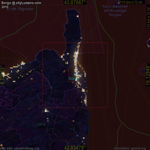
Analysis of Borgo night lights 2016
Square area 10x10 km:
 3.81%
3.81%90-99
6.19%80-89
3.49%70-79
2.22%60-69
4.29%50-59
4.13%40-49
3.02%30-39
2.06%20-29
8.41%10-19
33.17%0-9
29.21%Square area 50x50 km:
0.5%90-99
0.85%80-89
0.55%70-79
0.5%60-69
0.71%50-59
0.64%40-49
0.62%30-39
0.38%20-29
1.12%10-19
5.29%0-9
88.85%Clear (daylight) street map image can be seen on geolist.org.
Map coordinates:
43° 4' 14.4" North, 8° 43' 23.6" East
42° 33' 17.6" North, 9° 25' 34.9" East
42° 2' 5.2" North, 10° 7' 46.2" East
Some cities around Borgo sort by population:
• Ajaccio
90.6 km =56.3 mi,  218°
218°
• Bastia
16.6 km =10.3 mi,  6°
6°
• Piombino, IT
98.8 km =61.4 mi,  65°
65°
• Porto-Vecchio
107.9 km =67 mi,  186°
186°
• Portoferraio, IT
77.9 km =48.4 mi, 68°
• Corte
35.5 km =22.1 mi, 219°
• Biguglia
8 km =5 mi,  356°
356°
• Calvi
54.8 km =34.1 mi,  271°
271°
3031537 (p: 5,538)
Sources (retrieved 2019-11-25):
» Earth at Night: Flat Maps 2012, 2016