Belle de Mai night lights from space
Night Light of Belle de Mai (Provence-Alpes-Côte d'Azur) from space (France) Src. Average luminocity for 10x10km area is 86.7379% and for 50x50km: 29.4738%.
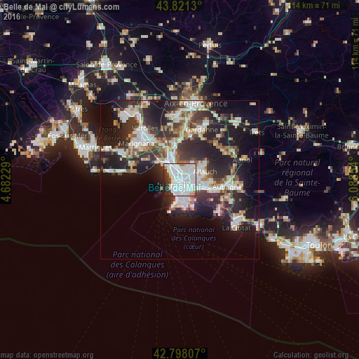
Analysis of Belle de Mai night lights 2016
Square area 10x10 km:
 55.45%
90-99
22.12%80-89
1.36%70-79
1.97%60-69
2.42%50-59
0.76%40-49
2.12%30-39
7.27%20-29
5.61%10-19
0.91%0-9
0%Square area 50x50 km:
6.66%90-99
6.51%80-89
2.96%70-79
2.28%60-69
2.8%50-59
3.04%40-49
3.22%30-39
5.59%20-29
10.71%10-19
15.42%0-9
40.82%Clear (daylight) street map image can be seen on geolist.org.
Map coordinates:
43° 49' 16.7" North, 4° 40' 56.2" East
43° 18' 42.6" North, 5° 23' 7.5" East
42° 47' 53.1" North, 6° 5' 18.7" East
Some cities around Belle de Mai sort by population:
• Cinq Avenues
1.3 km =0.8 mi,  132°
132°
• Saint-Mauront
0.9 km =0.6 mi,  296°
296°
• Bon-Secours
0.8 km =0.5 mi,  353°
353°
• Saint-Lazare
1.1 km =0.7 mi,  231°
231°
• Chutes-Lavie
0.8 km =0.5 mi,  103°
103°
• Saint-Charles
1.1 km =0.7 mi,  185°
185°
• La Villette
0.9 km =0.6 mi,  269°
269°
• Le Chapitre
1.3 km =0.8 mi,  183°
183°
11919744 (p: 14,256)
Sources (retrieved 2019-11-25):
» Earth at Night: Flat Maps 2012, 2016