Aubagne night lights from space
Night Light of Aubagne (Provence-Alpes-Côte d'Azur) from space (France) Src. Average luminocity for 10x10km area is 56.6061% and for 50x50km: 27.7223%.
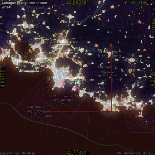

Analysis of Aubagne night lights 2016
Square area 10x10 km:
 9.24%
9.24%90-99
13.79%80-89
7.88%70-79
5.3%60-69
5.61%50-59
10%40-49
7.42%30-39
14.39%20-29
23.33%10-19
3.03%0-9
0%Square area 50x50 km:
5.99%90-99
5.83%80-89
2.92%70-79
2.06%60-69
3.17%50-59
3.03%40-49
3.14%30-39
4.67%20-29
9.72%10-19
14.52%0-9
44.95%Clear (daylight) street map image can be seen on geolist.org.
Map coordinates:
43° 48' 8.6" North, 4° 52' 3.2" East
43° 17' 33.9" North, 5° 34' 14.4" East
42° 46' 43.8" North, 6° 16' 25.7" East
Some cities around Aubagne sort by population:
• Allauch
8.6 km =5.3 mi,  303°
303°
• Saint-Marcel
8.5 km =5.3 mi,  266°
266°
• Cassis
9 km =5.6 mi,  196°
196°
• Roquevaire
6.9 km =4.3 mi,  22°
22°
• Carnoux-en-Provence
4.1 km =2.5 mi,  187°
187°
• La Penne-sur-Huveaune
4.5 km =2.8 mi,  254°
254°
• Gémenos
4.7 km =2.9 mi,  83°
83°
• Les Trois-Lucs
9.1 km =5.7 mi,  284°
284°
3036433 (p: 44,844)
Sources (retrieved 2019-11-25):
» Earth at Night: Flat Maps 2012, 2016