Turku night lights from space
Night Light of Turku (Southwest Finland) from space (Finland) Src. Average luminocity for 10x10km area is 90.7686% and for 50x50km: 12.6002%.
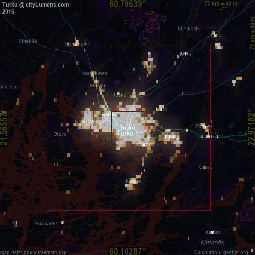
Analysis of Turku night lights 2016
Square area 10x10 km:
 48.04%
90-99
30.89%80-89
4.86%70-79
4.13%60-69
2.48%50-59
1.55%40-49
2.27%30-39
4.34%20-29
1.45%10-19
0%0-9
0%Square area 50x50 km:
3.22%90-99
2.83%80-89
0.93%70-79
1.04%60-69
1.26%50-59
1.13%40-49
1.21%30-39
1.72%20-29
3.04%10-19
6.73%0-9
76.88%Clear (daylight) street map image can be seen on geolist.org.
Map coordinates:
60° 47' 47" North, 21° 33' 56.1" East
60° 27' 5.3" North, 22° 16' 7.3" East
60° 6' 10.3" North, 22° 58' 18.6" East
Some cities around Turku sort by population:
• Raisio
6.7 km =4.2 mi,  305°
305°
• Kaarina
7.4 km =4.6 mi,  131°
131°
• Väståboland
17 km =10.6 mi,  174°
174°
• Lieto
12.4 km =7.7 mi,  58°
58°
• Naantali
13.5 km =8.4 mi,  277°
277°
• Pargas
16.2 km =10.1 mi, 173°
• Piikkiö
13.9 km =8.6 mi,  102°
102°
• Masku
16.2 km =10.1 mi,  324°
324°
633679 (p: 175,945)
Sources (retrieved 2019-11-25):
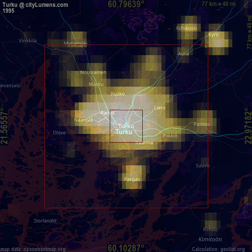
» NASA, Earths city lights 1995
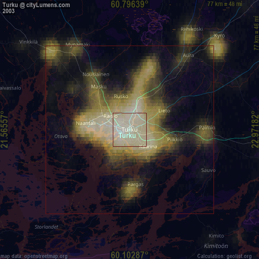
» NASA city lights 2003
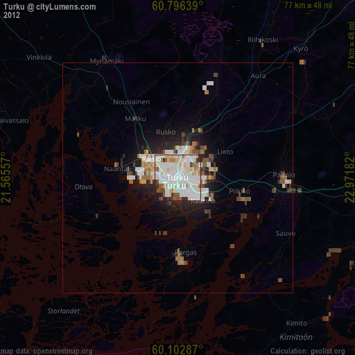
» Earth at Night: Flat Maps 2012, 2016