Haapajärvi night lights from space
Night Light of Haapajärvi (Northern Ostrobothnia) from space (Finland) Src. Average luminocity for 10x10km area is 11.3452% and for 50x50km: 1.0619%.
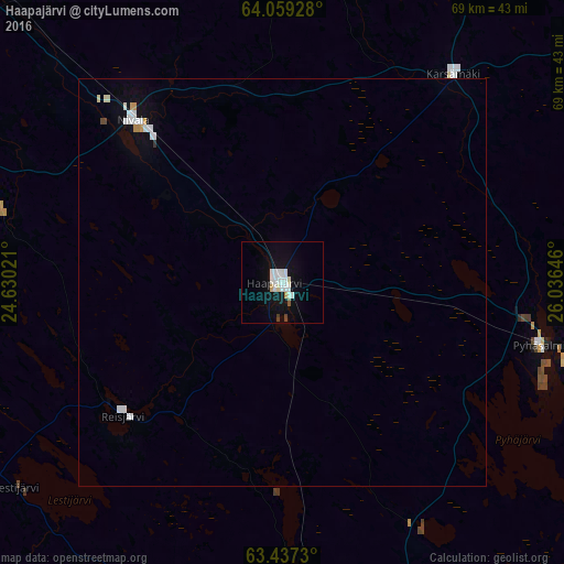
Analysis of Haapajärvi night lights 2016
Square area 10x10 km:
 3.27%
3.27%90-99
3.47%80-89
0.5%70-79
0.69%60-69
0%50-59
0.4%40-49
0.79%30-39
0%20-29
0%10-19
8.43%0-9
82.44%Square area 50x50 km:
0.27%90-99
0.3%80-89
0.06%70-79
0.1%60-69
0.02%50-59
0.02%40-49
0.06%30-39
0.02%20-29
0%10-19
0.56%0-9
98.59%Clear (daylight) street map image can be seen on geolist.org.
Map coordinates:
64° 3' 33.4" North, 24° 37' 48.8" East
63° 45' 0" North, 25° 19' 60" East
63° 26' 14.3" North, 26° 2' 11.3" East
Some cities around Haapajärvi sort by population:
• Ylivieska
53.3 km =33.1 mi,  314°
314°
• Nivala
25.8 km =16 mi,  315°
315°
• Kiuruvesi
64.2 km =39.9 mi,  99°
99°
• Oulainen
63.1 km =39.2 mi,  335°
335°
• Viitasaari
80.5 km =50 mi,  160°
160°
• Pyhäjärvi
29.4 km =18.3 mi,  108°
108°
• Kannus
72.3 km =44.9 mi,  283°
283°
• Sievi
44.1 km =27.4 mi,  292°
292°
659681 (p: 7,627)
Sources (retrieved 2019-11-25):
» Earth at Night: Flat Maps 2012, 2016