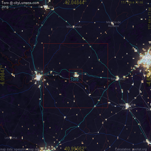
Toro night lights from space
Night Light of Toro (Castille and León) from space (Spain) Src. Average luminocity for 10x10km area is 11.1684% and for 50x50km: 1.3842%.
Analysis of Toro night lights 2016
Square area 10x10 km:
 1.02%
1.02%90-99
1.7%80-89
3.74%70-79
1.02%60-69
1.36%50-59
0.68%40-49
0.17%30-39
0.51%20-29
1.87%10-19
0.68%0-9
87.24%Square area 50x50 km:
0.06%90-99
0.13%80-89
0.31%70-79
0.15%60-69
0.21%50-59
0.28%40-49
0.18%30-39
0.2%20-29
0.31%10-19
0.22%0-9
97.95%Clear (daylight) street map image can be seen on geolist.org.
Map coordinates:
42° 2' 54.4" North, 6° 5' 54.5" West
41° 31' 27" North, 5° 23' 43.2" West
40° 59' 44.2" North, 4° 41' 32" West
Some cities around Toro sort by population:
• Valladolid
57.7 km =35.9 mi,  75°
75°
• Zamora
29.1 km =18.1 mi,  266°
266°
• Laguna de Duero
56.3 km =35 mi, 83°
• Medina del Campo
46.5 km =28.9 mi,  120°
120°
• Benavente
58.1 km =36.1 mi,  336°
336°
• Arroyo de la Encomienda
50.7 km =31.5 mi, 79°
• Tordesillas
32.9 km =20.4 mi,  94°
94°
• Medina de Ríoseco
49.4 km =30.7 mi,  36°
36°
3107886 (p: 9,556)
Sources (retrieved 2019-11-25):
» Earth at Night: Flat Maps 2012, 2016