Telde night lights from space
Night Light of Telde (Canary Islands) from space (Spain) Src. Average luminocity for 10x10km area is 73.2689% and for 50x50km: 24.3209%.
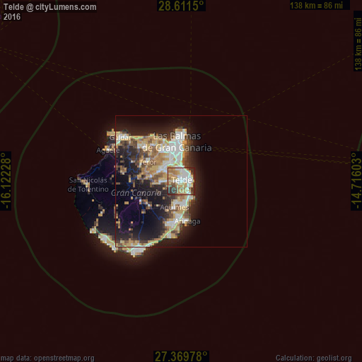
Analysis of Telde night lights 2016
Square area 10x10 km:
 15.34%
90-99
17.8%80-89
15.53%70-79
14.96%60-69
9.85%50-59
4.92%40-49
5.11%30-39
10.23%20-29
6.25%10-19
0%0-9
0%Square area 50x50 km:
3.29%90-99
4.18%80-89
4.09%70-79
4.6%60-69
2.6%50-59
2.72%40-49
3.23%30-39
3.81%20-29
6.75%10-19
12.93%0-9
51.81%Clear (daylight) street map image can be seen on geolist.org.
Map coordinates:
28° 36' 41.4" North, 16° 7' 20.2" West
27° 59' 32.7" North, 15° 25' 8.9" West
27° 22' 11.2" North, 14° 42' 57.7" West
Some cities around Telde sort by population:
• Las Palmas de Gran Canaria
11.9 km =7.4 mi,  2°
2°
• Ingenio
8.3 km =5.2 mi,  190°
190°
• Agüimes
10 km =6.2 mi,  195°
195°
• Carrizal
9.1 km =5.7 mi,  171°
171°
• Santa Brígida
9.4 km =5.8 mi,  297°
297°
• Teror
14.8 km =9.2 mi, 300°
• Valsequillo de Gran Canaria
7.7 km =4.8 mi,  264°
264°
• Vega de San Mateo
11.4 km =7.1 mi,  279°
279°
2510542 (p: 100,015)
Sources (retrieved 2019-11-25):
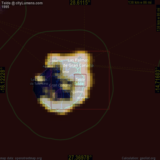
» NASA, Earths city lights 1995
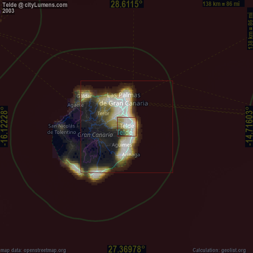
» NASA city lights 2003
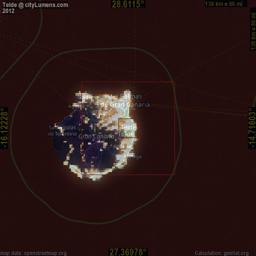
» Earth at Night: Flat Maps 2012, 2016