Sestao night lights from space
Night Light of Sestao (Basque Country) from space (Spain) Src. Average luminocity for 10x10km area is 80.3924% and for 50x50km: 18.7716%.
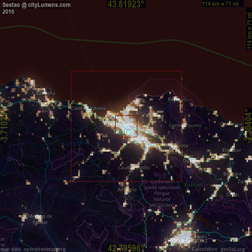
Analysis of Sestao night lights 2016
Square area 10x10 km:
 30.61%
90-99
27.58%80-89
4.7%70-79
4.39%60-69
8.48%50-59
7.42%40-49
5.61%30-39
6.52%20-29
4.55%10-19
0.15%0-9
0%Square area 50x50 km:
3.11%90-99
3.61%80-89
1.77%70-79
1.85%60-69
2.34%50-59
2.7%40-49
2.15%30-39
2.77%20-29
5.55%10-19
12.88%0-9
61.27%Clear (daylight) street map image can be seen on geolist.org.
Map coordinates:
43° 49' 9.2" North, 3° 42' 37" West
43° 18' 35.1" North, 3° 0' 25.8" West
42° 47' 45.5" North, 2° 18' 14.5" West
Some cities around Sestao sort by population:
• Barakaldo
2.1 km =1.3 mi,  133°
133°
• Algorta
4.4 km =2.7 mi,  357°
357°
• Getxo
5.3 km =3.3 mi, 356°
• Portugalete
1.7 km =1.1 mi,  318°
318°
• Santurtzi
2.9 km =1.8 mi, 315°
• Leioa
2.4 km =1.5 mi,  37°
37°
• Erandio
2.8 km =1.7 mi,  102°
102°
• Ortuella
4 km =2.5 mi,  272°
272°
3109041 (p: 29,476)
Sources (retrieved 2019-11-25):
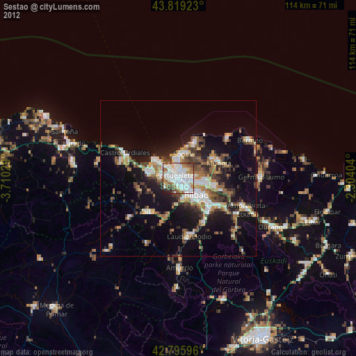
» Earth at Night: Flat Maps 2012, 2016