San Adrián night lights from space
Night Light of San Adrián (Navarre) from space (Spain) Src. Average luminocity for 10x10km area is 24.4206% and for 50x50km: 6.5168%.
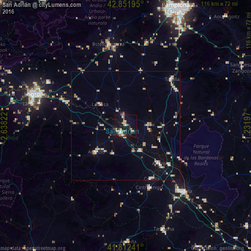
Analysis of San Adrián night lights 2016
Square area 10x10 km:
 3.49%
3.49%90-99
3.17%80-89
4.6%70-79
1.43%60-69
5.4%50-59
2.38%40-49
2.22%30-39
1.9%20-29
0.48%10-19
32.7%0-9
42.22%Square area 50x50 km:
0.78%90-99
1.08%80-89
0.92%70-79
0.63%60-69
0.9%50-59
0.55%40-49
0.49%30-39
0.43%20-29
0.71%10-19
2.52%0-9
91.01%Clear (daylight) street map image can be seen on geolist.org.
Map coordinates:
42° 51' 7" North, 2° 38' 17.6" West
42° 20' 3.6" North, 1° 56' 6.3" West
41° 48' 44.7" North, 1° 13' 55.1" West
Some cities around San Adrián sort by population:
• Calahorra
4.1 km =2.5 mi,  217°
217°
• Arnedo
18 km =11.2 mi,  229°
229°
• Estella-Lizarra
38.4 km =23.9 mi,  348°
348°
• Tafalla
30.3 km =18.8 mi,  44°
44°
• Alfaro
22.9 km =14.2 mi,  138°
138°
• Corella
27.3 km =17 mi,  153°
153°
• Cintruénigo
30.3 km =18.8 mi,  159°
159°
• Peralta
11.1 km =6.9 mi,  87°
87°
3110924 (p: 6,076)
Sources (retrieved 2019-11-25):
» Earth at Night: Flat Maps 2012, 2016