Cintruénigo night lights from space
Night Light of Cintruénigo (Navarre) from space (Spain) Src. Average luminocity for 10x10km area is 11.3576% and for 50x50km: 6.3533%.
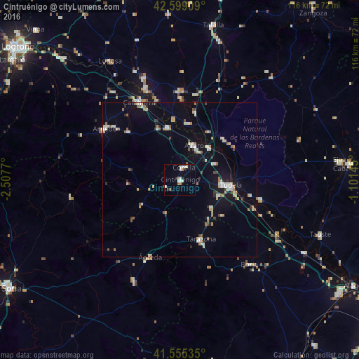
Analysis of Cintruénigo night lights 2016
Square area 10x10 km:
 2.12%
2.12%90-99
3.18%80-89
0.76%70-79
0.61%60-69
1.67%50-59
1.06%40-49
0%30-39
0.3%20-29
1.21%10-19
1.06%0-9
88.03%Square area 50x50 km:
0.71%90-99
1.22%80-89
0.71%70-79
0.57%60-69
0.88%50-59
0.51%40-49
0.43%30-39
0.37%20-29
0.74%10-19
3.27%0-9
90.59%Clear (daylight) street map image can be seen on geolist.org.
Map coordinates:
42° 35' 56.7" North, 2° 30' 27.7" West
42° 4' 45.7" North, 1° 48' 16.5" West
41° 33' 19.3" North, 1° 6' 5.2" West
Some cities around Cintruénigo sort by population:
• Tudela
16.6 km =10.3 mi,  96°
96°
• Calahorra
28.4 km =17.6 mi,  332°
332°
• Arnedo
29.5 km =18.3 mi,  304°
304°
• Tarazona
20.5 km =12.7 mi,  161°
161°
• Alfaro
12.1 km =7.5 mi,  21°
21°
• Corella
4.3 km =2.7 mi, 21°
• San Adrián
30.3 km =18.8 mi,  339°
339°
• Peralta
28.8 km =17.9 mi,  0°
0°
3125009 (p: 6,708)
Sources (retrieved 2019-11-25):
» Earth at Night: Flat Maps 2012, 2016