Lugones night lights from space
Night Light of Lugones (Asturias) from space (Spain) Src. Average luminocity for 10x10km area is 64.9143% and for 50x50km: 21.0922%.
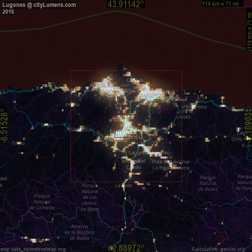
Analysis of Lugones night lights 2016
Square area 10x10 km:
 17.14%
90-99
15.71%80-89
5.87%70-79
5.24%60-69
7.46%50-59
16.67%40-49
6.67%30-39
8.89%20-29
15.24%10-19
1.11%0-9
0%Square area 50x50 km:
3.29%90-99
3.71%80-89
1.41%70-79
1.74%60-69
1.81%50-59
4.09%40-49
2.3%30-39
4.24%20-29
9.64%10-19
16.65%0-9
51.12%Clear (daylight) street map image can be seen on geolist.org.
Map coordinates:
43° 54' 41.1" North, 6° 30' 55" West
43° 24' 9.8" North, 5° 48' 43.7" West
42° 53' 23" North, 5° 6' 32.5" West
Some cities around Lugones sort by population:
• Oviedo
5.4 km =3.4 mi,  209°
209°
• Sama
15.8 km =9.8 mi,  138°
138°
• Mieres
17.4 km =10.8 mi,  167°
167°
• Natahoyo
18.5 km =11.5 mi,  34°
34°
• Corvera de Asturias
16 km =9.9 mi,  337°
337°
• Llanera
11.6 km =7.2 mi,  304°
304°
• Pola de Siero
12.1 km =7.5 mi,  95°
95°
• El entrego
19 km =11.8 mi,  132°
132°
3117811 (p: 14,000)
Sources (retrieved 2019-11-25):
» Earth at Night: Flat Maps 2012, 2016