Huéscar night lights from space
Night Light of Huéscar (Andalusia) from space (Spain) Src. Average luminocity for 10x10km area is 4.7245% and for 50x50km: 0.7387%.
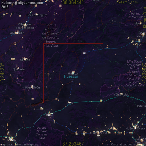
Analysis of Huéscar night lights 2016
Square area 10x10 km:
 0%
0%90-99
0.68%80-89
1.36%70-79
0.51%60-69
1.36%50-59
0.17%40-49
0.68%30-39
1.36%20-29
0%10-19
0%0-9
93.88%Square area 50x50 km:
0%90-99
0.13%80-89
0.21%70-79
0.03%60-69
0.13%50-59
0.16%40-49
0.11%30-39
0.2%20-29
0.09%10-19
0.08%0-9
98.84%Clear (daylight) street map image can be seen on geolist.org.
Map coordinates:
38° 21' 52" North, 3° 14' 39.4" West
37° 48' 39.7" North, 2° 32' 28.2" West
37° 15' 12.5" North, 1° 50' 16.9" West
Some cities around Huéscar sort by population:
• Baza
41 km =25.5 mi,  209°
209°
• Villanueva del Arzobispo
57 km =35.4 mi,  314°
314°
• Cazorla
42.2 km =26.2 mi,  285°
285°
• Velez Rubio
44.7 km =27.8 mi,  113°
113°
• Olula del Río
55.1 km =34.2 mi,  157°
157°
• Quesada
46.2 km =28.7 mi,  274°
274°
• Peal de Becerro
52.2 km =32.4 mi,  282°
282°
• Pozo Alcón
36.6 km =22.7 mi,  250°
250°
2516507 (p: 8,194)
Sources (retrieved 2019-11-25):
» Earth at Night: Flat Maps 2012, 2016