Garrucha night lights from space
Night Light of Garrucha (Andalusia) from space (Spain) Src. Average luminocity for 10x10km area is 19.9592% and for 50x50km: 4.7846%.
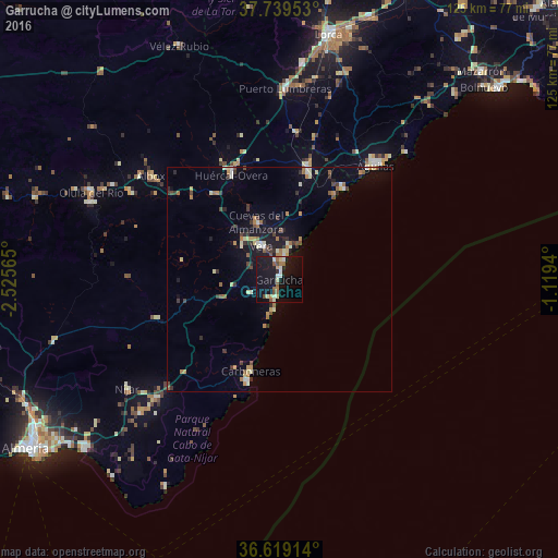
Analysis of Garrucha night lights 2016
Square area 10x10 km:
 1.36%
1.36%90-99
4.08%80-89
2.38%70-79
0.85%60-69
3.4%50-59
2.89%40-49
2.04%30-39
0%20-29
1.36%10-19
36.73%0-9
44.9%Square area 50x50 km:
0.32%90-99
0.63%80-89
0.62%70-79
0.45%60-69
0.83%50-59
0.6%40-49
0.59%30-39
0.8%20-29
0.69%10-19
3.55%0-9
90.91%Clear (daylight) street map image can be seen on geolist.org.
Map coordinates:
37° 44' 22.3" North, 2° 31' 32.3" West
37° 10' 53.1" North, 1° 49' 21.1" West
36° 37' 8.9" North, 1° 7' 9.8" West
Some cities around Garrucha sort by population:
• Águilas
32.8 km =20.4 mi,  40°
40°
• Huércal-Overa
25.4 km =15.8 mi,  335°
335°
• Vera
7.6 km =4.7 mi,  334°
334°
• Cuevas del Almanzora
13.9 km =8.6 mi, 337°
• Albox
37 km =23 mi,  308°
308°
• Pulpí
26.5 km =16.5 mi,  15°
15°
• Carboneras
21.6 km =13.4 mi,  197°
197°
• Mojacar
5.2 km =3.2 mi,  208°
208°
2517310 (p: 6,920)
Sources (retrieved 2019-11-25):
» Earth at Night: Flat Maps 2012, 2016