Cadiz night lights from space
Night Light of Cadiz (Andalusia) from space (Spain) Src. Average luminocity for 10x10km area is 38.6832% and for 50x50km: 16.6428%.
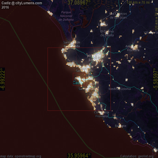

Analysis of Cadiz night lights 2016
Square area 10x10 km:
 10.07%
90-99
6.78%80-89
2.01%70-79
3.66%60-69
5.49%50-59
1.1%40-49
4.4%30-39
9.34%20-29
18.13%10-19
21.06%0-9
17.95%Square area 50x50 km:
2.46%90-99
2.48%80-89
1.9%70-79
2.18%60-69
2.5%50-59
0.8%40-49
2.11%30-39
4%20-29
6.12%10-19
13.98%0-9
61.47%Clear (daylight) street map image can be seen on geolist.org.
Map coordinates:
37° 5' 22.8" North, 6° 59' 32" West
36° 31' 36.2" North, 6° 17' 20.8" West
35° 57' 34.7" North, 5° 35' 9.5" West
Some cities around Cadiz sort by population:
• Jerez de la Frontera
22.4 km =13.9 mi,  37°
37°
• San Fernando
9.9 km =6.2 mi,  124°
124°
• El Puerto de Santa María
9 km =5.6 mi,  33°
33°
• Chiclana de la Frontera
17.6 km =10.9 mi,  132°
132°
• Sanlúcar de Barrameda
28.5 km =17.7 mi,  348°
348°
• Puerto Real
8.8 km =5.5 mi,  88°
88°
• Rota
12.8 km =8 mi,  329°
329°
• Chipiona
26.8 km =16.7 mi, 330°
2520600 (p: 126,766)
Sources (retrieved 2019-11-25):
» NASA, Earths city lights 1995
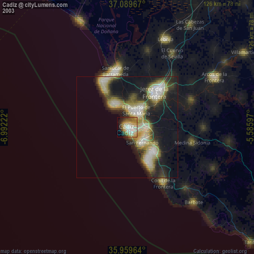
» NASA city lights 2003
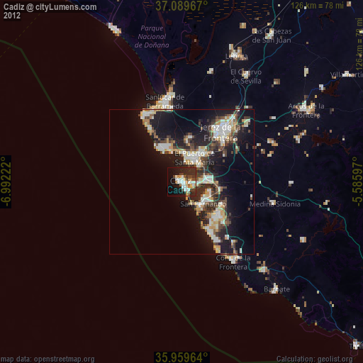
» Earth at Night: Flat Maps 2012, 2016