Bailén night lights from space
Night Light of Bailén (Andalusia) from space (Spain) Src. Average luminocity for 10x10km area is 12.2062% and for 50x50km: 4.8419%.
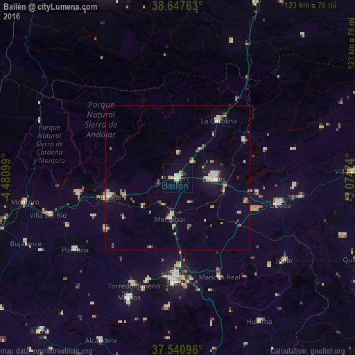
Analysis of Bailén night lights 2016
Square area 10x10 km:
 1.95%
1.95%90-99
1.3%80-89
0.97%70-79
2.6%60-69
1.79%50-59
0.81%40-49
0%30-39
1.3%20-29
1.3%10-19
0.49%0-9
87.5%Square area 50x50 km:
0.56%90-99
0.75%80-89
0.51%70-79
0.64%60-69
0.71%50-59
0.48%40-49
0.36%30-39
0.61%20-29
0.69%10-19
1.91%0-9
92.77%Clear (daylight) street map image can be seen on geolist.org.
Map coordinates:
38° 38' 51.5" North, 4° 28' 51.6" West
38° 5' 47" North, 3° 46' 40.3" West
37° 32' 27.5" North, 3° 4' 29.1" West
Some cities around Bailén sort by population:
• Jaén
36.4 km =22.6 mi,  181°
181°
• Linares
12.4 km =7.7 mi,  90°
90°
• Andújar
24.7 km =15.3 mi,  255°
255°
• Baeza
29.2 km =18.1 mi,  112°
112°
• La Carolina
24.5 km =15.2 mi,  35°
35°
• Mengibar
14.3 km =8.9 mi,  190°
190°
• Marmolejo
34.8 km =21.6 mi, 260°
• Arjona
30.2 km =18.8 mi,  233°
233°
2521410 (p: 18,785)
Sources (retrieved 2019-11-25):
» Earth at Night: Flat Maps 2012, 2016