Avilés night lights from space
Night Light of Avilés (Asturias) from space (Spain) Src. Average luminocity for 10x10km area is 63.1921% and for 50x50km: 16.2196%.
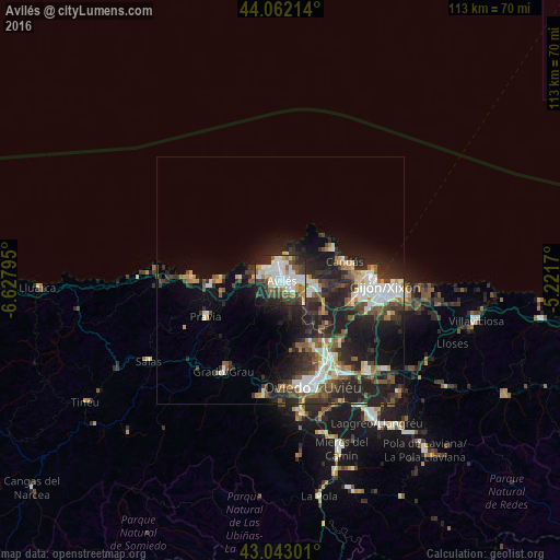
Analysis of Avilés night lights 2016
Square area 10x10 km:
 20.32%
90-99
15.56%80-89
4.76%70-79
5.24%60-69
6.35%50-59
7.62%40-49
7.62%30-39
9.37%20-29
15.56%10-19
7.3%0-9
0.32%Square area 50x50 km:
2.75%90-99
2.97%80-89
1.2%70-79
1.27%60-69
1.46%50-59
2.9%40-49
2.01%30-39
3.43%20-29
7.82%10-19
9.63%0-9
64.56%Clear (daylight) street map image can be seen on geolist.org.
Map coordinates:
44° 3' 43.7" North, 6° 37' 40.6" West
43° 33' 17" North, 5° 55' 29.4" West
43° 2' 34.8" North, 5° 13' 18.1" West
Some cities around Avilés sort by population:
• Gijón
21.3 km =13.2 mi,  95°
95°
• Natahoyo
19.6 km =12.2 mi,  94°
94°
• Corvera de Asturias
3.6 km =2.2 mi,  126°
126°
• Lugones
19.2 km =11.9 mi,  151°
151°
• Llanera
10.3 km =6.4 mi,  182°
182°
• Luanco
12.5 km =7.8 mi,  57°
57°
• Piedras Blancas
4.1 km =2.5 mi,  276°
276°
• Cudillero
17.8 km =11.1 mi,  272°
272°
3129135 (p: 84,242)
Sources (retrieved 2019-11-25):
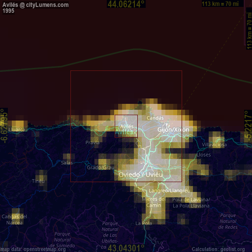
» NASA, Earths city lights 1995
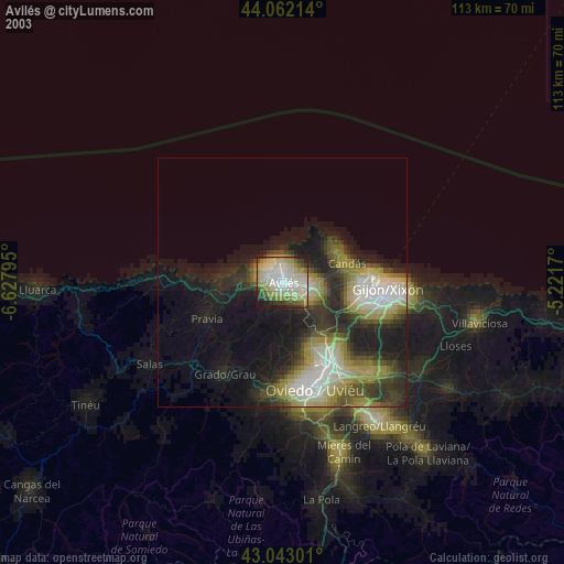
» NASA city lights 2003
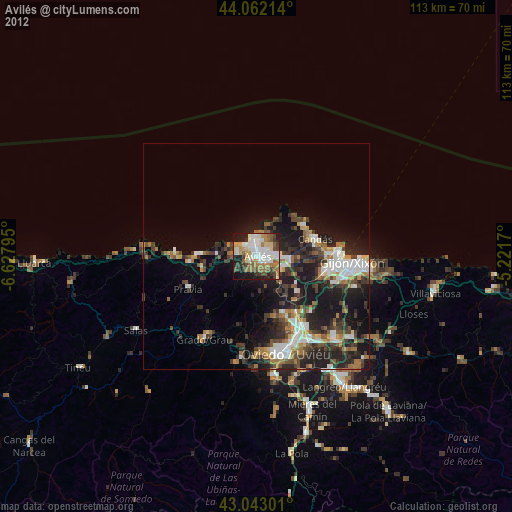
» Earth at Night: Flat Maps 2012, 2016