Arganda night lights from space
Night Light of Arganda (Madrid) from space (Spain) Src. Average luminocity for 10x10km area is 37.4099% and for 50x50km: 34.316%.
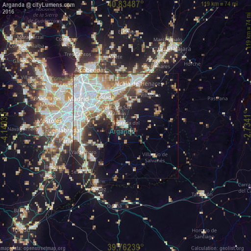
Analysis of Arganda night lights 2016
Square area 10x10 km:
 7.31%
7.31%90-99
6.8%80-89
3.23%70-79
4.93%60-69
2.72%50-59
3.57%40-49
4.25%30-39
5.61%20-29
15.48%10-19
39.46%0-9
6.63%Square area 50x50 km:
10.4%90-99
7.94%80-89
2.99%70-79
3.61%60-69
3.65%50-59
3.69%40-49
3.05%30-39
3.73%20-29
6.41%10-19
10.19%0-9
44.34%Clear (daylight) street map image can be seen on geolist.org.
Map coordinates:
40° 50' 5.5" North, 4° 8' 25.3" West
40° 18' 2.7" North, 3° 26' 14" West
39° 45' 44.6" North, 2° 44' 2.8" West
Some cities around Arganda sort by population:
• Rivas-Vaciamadrid
6.8 km =4.2 mi,  294°
294°
• Villa de Vallecas
15.7 km =9.8 mi,  297°
297°
• San Fernando de Henares
15.9 km =9.9 mi,  329°
329°
• Mejorada del Campo
10.9 km =6.8 mi,  339°
339°
• San Martín de la Vega
15.4 km =9.6 mi,  227°
227°
• Velilla de San Antonio
8.2 km =5.1 mi, 330°
• Morata de Tajuña
8.2 km =5.1 mi,  177°
177°
• Torres de la Alameda
13.2 km =8.2 mi,  30°
30°
3129636 (p: 51,489)
Sources (retrieved 2019-11-25):
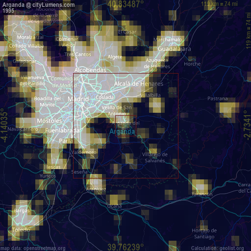
» NASA, Earths city lights 1995
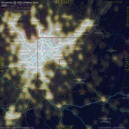
» NASA city lights 2003
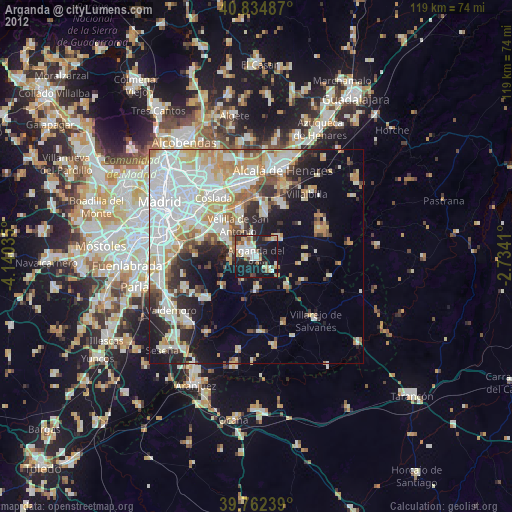
» Earth at Night: Flat Maps 2012, 2016