Almassora night lights from space
Night Light of Almassora (Valencia) from space (Spain) Src. Average luminocity for 10x10km area is 61.6803% and for 50x50km: 15.1226%.
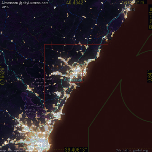

Analysis of Almassora night lights 2016
Square area 10x10 km:
 15.65%
90-99
16.16%80-89
5.1%70-79
4.42%60-69
9.35%50-59
8.5%40-49
6.97%30-39
12.59%20-29
14.8%10-19
6.29%0-9
0.17%Square area 50x50 km:
1.97%90-99
2.37%80-89
2%70-79
1.56%60-69
2.05%50-59
1.87%40-49
1.26%30-39
1.97%20-29
4.92%10-19
14.36%0-9
65.66%Clear (daylight) street map image can be seen on geolist.org.
Map coordinates:
40° 29' 3.1" North, 0° 45' 58.5" West
39° 56' 50.2" North, 0° 3' 47.3" West
39° 24' 22.1" North, 0° 38' 24" East
Some cities around Almassora sort by population:
• Castelló de la Plana
4.4 km =2.7 mi,  15°
15°
• Vila-real
3.4 km =2.1 mi,  252°
252°
• Burriana
6.7 km =4.2 mi,  196°
196°
• Onda
16.9 km =10.5 mi,  276°
276°
• Benicàssim
15.9 km =9.9 mi,  44°
44°
• El Grao
7.1 km =4.4 mi,  65°
65°
• Nules
13.1 km =8.1 mi,  217°
217°
• Betxí
11.8 km =7.3 mi,  262°
262°
2521909 (p: 24,963)
Sources (retrieved 2019-11-25):
» Earth at Night: Flat Maps 2012, 2016