Vila-real night lights from space
Night Light of Vila-real (Valencia) from space (Spain) Src. Average luminocity for 10x10km area is 57.8265% and for 50x50km: 15.3936%.
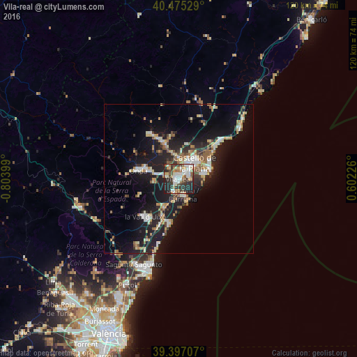
Analysis of Vila-real night lights 2016
Square area 10x10 km:
 12.07%
90-99
14.46%80-89
6.46%70-79
5.61%60-69
7.31%50-59
6.29%40-49
6.97%30-39
11.56%20-29
23.64%10-19
5.61%0-9
0%Square area 50x50 km:
1.98%90-99
2.41%80-89
2.02%70-79
1.62%60-69
2.09%50-59
1.87%40-49
1.33%30-39
2.04%20-29
5.11%10-19
14.63%0-9
64.89%Clear (daylight) street map image can be seen on geolist.org.
Map coordinates:
40° 28' 31" North, 0° 48' 14.4" West
39° 56' 17.9" North, 0° 6' 3.1" West
39° 23' 49.5" North, 0° 36' 8.1" East
Some cities around Vila-real sort by population:
• Castelló de la Plana
6.9 km =4.3 mi,  39°
39°
• Burriana
5.6 km =3.5 mi,  166°
166°
• Onda
13.9 km =8.6 mi,  282°
282°
• Almassora
3.4 km =2.1 mi,  72°
72°
• El Grao
10.5 km =6.5 mi, 67°
• Nules
10.5 km =6.5 mi,  206°
206°
• l'Alcora
16.6 km =10.3 mi,  329°
329°
• Betxí
8.5 km =5.3 mi,  266°
266°
2509509 (p: 51,205)
Sources (retrieved 2019-11-25):
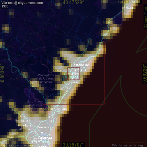
» NASA, Earths city lights 1995
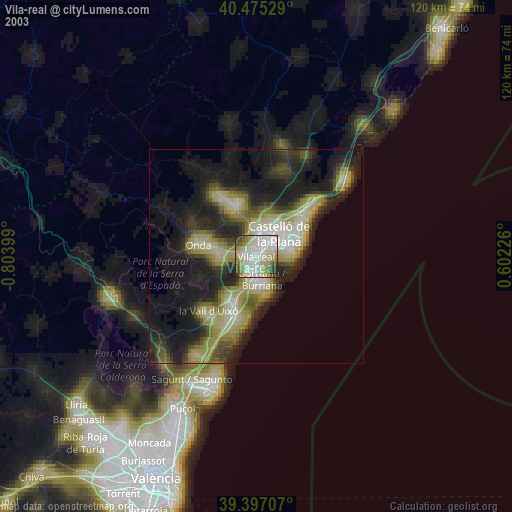
» NASA city lights 2003
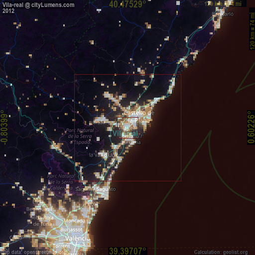
» Earth at Night: Flat Maps 2012, 2016