Alhaurín el Grande night lights from space
Night Light of Alhaurín el Grande (Andalusia) from space (Spain) Src. Average luminocity for 10x10km area is 18.5458% and for 50x50km: 17.8462%.
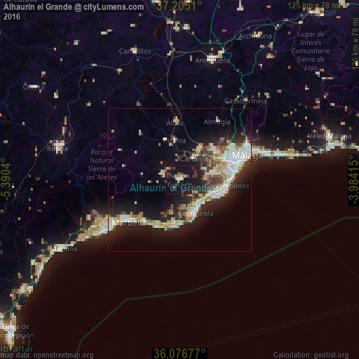
Analysis of Alhaurín el Grande night lights 2016
Square area 10x10 km:
 0.92%
0.92%90-99
0.55%80-89
2.2%70-79
2.56%60-69
3.48%50-59
1.28%40-49
2.56%30-39
4.03%20-29
2.75%10-19
29.67%0-9
50%Square area 50x50 km:
3.17%90-99
3.34%80-89
1.83%70-79
1.94%60-69
2.9%50-59
1.42%40-49
1.92%30-39
2.46%20-29
5.54%10-19
12.45%0-9
63.04%Clear (daylight) street map image can be seen on geolist.org.
Map coordinates:
37° 12' 18.4" North, 5° 23' 25.4" West
36° 38' 34.8" North, 4° 41' 14.2" West
36° 4' 36.4" North, 3° 59' 2.9" West
Some cities around Alhaurín el Grande sort by population:
• Mijas
6.9 km =4.3 mi,  139°
139°
• Fuengirola
12.7 km =7.9 mi,  154°
154°
• Torremolinos
16.9 km =10.5 mi,  98°
98°
• Benalmádena
11.5 km =7.1 mi,  117°
117°
• Coín
6.4 km =4 mi,  286°
286°
• Cártama
8.9 km =5.5 mi,  32°
32°
• Alora
20.1 km =12.5 mi,  355°
355°
• Pizarra
13.7 km =8.5 mi,  352°
352°
2521985 (p: 23,319)
Sources (retrieved 2019-11-25):
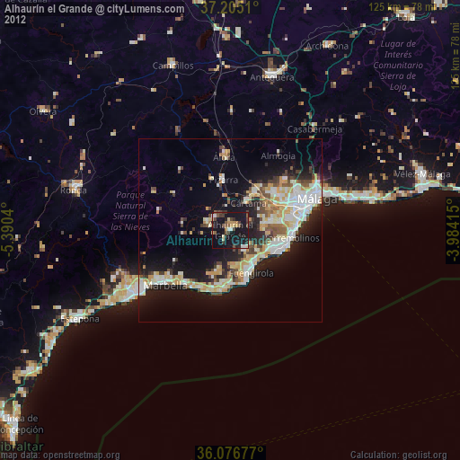
» Earth at Night: Flat Maps 2012, 2016